IMAGES TAKEN NEAR TO
Hanover Street, HERNE BAY, CT6 5RW
Introduction
This page details the photographs taken nearby to Hanover Street, CT6 5RW by members of the Geograph project.
The Geograph project started in 2005 with the aim of publishing, organising and preserving representative images for every square kilometre of Great Britain, Ireland and the Isle of Man.

There are currently over 7.5m images from over14,400 individuals and you can help contribute to the project by visiting https://www.geograph.org.uk
Image Map
Images are licensed for reuse under creativecommons.org/licenses/by-sa/2.0
Notes
- Clicking on the map will re-center to the selected point.
- The higher the marker number, the further away the image location is from the centre of the postcode.
Image Listing (346 Images Found)
Images are licensed for reuse under creativecommons.org/licenses/by-sa/2.0
Image
Details
Distance
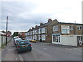
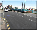
3
Redevelopment of 32-34, High Street
Planning permission has been granted by Canterbury City Council under application number CA//13/00098 for the “demolition of existing portal framed building and replacement with 8 residential apartments with associated communal space (revised scheme)”. This address used to be Image but is now Image
Image: © John Baker
Taken: 11 Sep 2016
0.05 miles
4
Interior Interiors, 32-34, High Street
Between the boarded up windows, someone has written moving on sale.
Image: © John Baker
Taken: 25 Jan 2016
0.06 miles
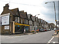
5
74, High Street
This used to be the Image Planning permission has been granted by Canterbury City Council under application number CA//17/02055 for a “proposed three, four, and five-storey mixed use development comprising of 900 sq m of retail floor space to the High Street frontage together with twenty one 3-bed dwellings, two 1-bed flats and twenty-seven 2-bed flats together with access, parking and courtyard amenity area following demolition of the existing buildings”.
Image: © John Baker
Taken: 26 May 2019
0.06 miles
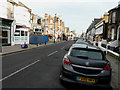
6
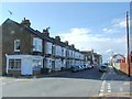
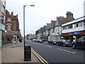
Herne Bay High Street
Not the most attractive of High Streets, the shops in this view included a fishing tackle shop and a hospice charity shop.
Image: © Stephen Craven
Taken: 24 Jul 2010
0.06 miles
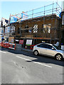
7
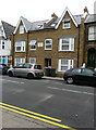
Crockett House, 32-34, High Street
The Image has been completed and the building is now occupied. The name of the house has been added, to the frontage, in the form of a plaque with raised lettering.
Image: © John Baker
Taken: 10 Sep 2017
0.07 miles
8
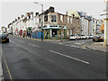
Looking east along the High Street
On the left is the fire-gutted Image
Image: © John Baker
Taken: 25 Jan 2016
0.07 miles
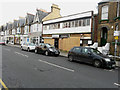
10
Poppadoms Indian Restaurant, 33 High Street
Situated on the corner of Dolphin Street, this former restaurant was gutted by a fire, that was thought to have started at 4 am on 6 December 2015 http://www.kentonline.co.uk/herne-bay/news/homes-evacuated-after-fire-above-47470/
Image: © John Baker
Taken: 25 Jan 2016
0.07 miles