IMAGES TAKEN NEAR TO
Chestfield Road, WHITSTABLE, CT5 3LF
Introduction
This page details the photographs taken nearby to Chestfield Road, CT5 3LF by members of the Geograph project.
The Geograph project started in 2005 with the aim of publishing, organising and preserving representative images for every square kilometre of Great Britain, Ireland and the Isle of Man.

There are currently over 7.5m images from over14,400 individuals and you can help contribute to the project by visiting https://www.geograph.org.uk
Image Map
Images are licensed for reuse under creativecommons.org/licenses/by-sa/2.0
Notes
- Clicking on the map will re-center to the selected point.
- The higher the marker number, the further away the image location is from the centre of the postcode.
Image Listing (42 Images Found)
Images are licensed for reuse under creativecommons.org/licenses/by-sa/2.0
Image
Details
Distance
3
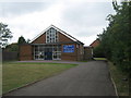
Catholic Church of St. Joseph, Chestfield
On Chestfield Road.
Image: © David Anstiss
Taken: 21 Aug 2010
0.07 miles
4
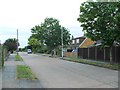
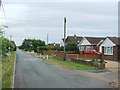
A short stretch of 'the old road'
Presumably once the route of the A2990, which has now been disconnected from the public highway network when the nearby former road junction was converted to newer roundabouts.
Image: © Richard Law
Taken: 17 Aug 2014
0.11 miles
6
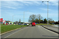
Roundabout on A2990 Thanet Way
The original A299, now bypassed by a newer alignment. This roundabout was inserted since then.
Image: © Robin Webster
Taken: 8 Feb 2018
0.13 miles
7
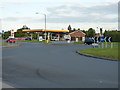
Shell garage in Chestfield
At the junction of the A2990 Thanet Way with the B2205 coast road
Image: © Richard Law
Taken: 17 Aug 2014
0.14 miles
8
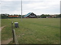
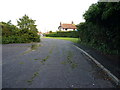
Chestfield Rugby club pavilion
This club is on Reeves Way. Seen from a footpath leading from Primrose Way to Sainsbury Supermarket. (Unseen on left). Sainsbury Petrol Station can be seen on Reeves Way in the background.
Image: © David Anstiss
Taken: 1 Aug 2009
0.14 miles
9
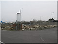
Rubble before the rising of KFC in Chestfield
Close to the existing McDonald's on the first roundabout on the A2990, this former garage has been empty for many years since it closed. Now construction of a new KFC will begin to take place soon.
Image: © David Anstiss
Taken: 18 Mar 2010
0.15 miles
10
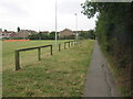
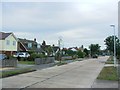
Footpath beside Chestfield Rugby ground
This path leads from the club pavilion and Sainsbury's Supermarket (behind hedge on right), to Primrose Way.
Image: © David Anstiss
Taken: 1 Aug 2009
0.15 miles