IMAGES TAKEN NEAR TO
Ridgeway, WHITSTABLE, CT5 3JT
Introduction
This page details the photographs taken nearby to Ridgeway, CT5 3JT by members of the Geograph project.
The Geograph project started in 2005 with the aim of publishing, organising and preserving representative images for every square kilometre of Great Britain, Ireland and the Isle of Man.

There are currently over 7.5m images from over14,400 individuals and you can help contribute to the project by visiting https://www.geograph.org.uk
Image Map
Images are licensed for reuse under creativecommons.org/licenses/by-sa/2.0
Notes
- Clicking on the map will re-center to the selected point.
- The higher the marker number, the further away the image location is from the centre of the postcode.
Image Listing (18 Images Found)
Images are licensed for reuse under creativecommons.org/licenses/by-sa/2.0
Image
Details
Distance
1
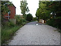
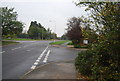
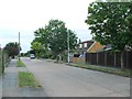
The end of the metalled road on Ridgeway
The Ridgeway here is a bridleway which runs essentially east-west from Chestfield to South Tankerton, joining Chestfield Road to Clover Rise. At each end, it provides access to a number of properties, whilst the central section is narrow and unsurfaced, much more typical of a rural track.
Image: © Richard Law
Taken: 17 Aug 2014
0.03 miles
3
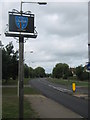
Chestfield Village Sign
On Chestfield Road.
Image: © David Anstiss
Taken: 21 Aug 2010
0.08 miles
4
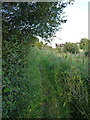
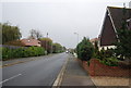
Central section of The Ridgeway
A bridleway between Chestfield and South Tankerton.
Image: © Richard Law
Taken: 17 Aug 2014
0.14 miles
6
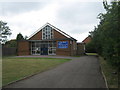
Catholic Church of St. Joseph, Chestfield
On Chestfield Road.
Image: © David Anstiss
Taken: 21 Aug 2010
0.16 miles
8
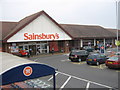
Sainsbury's Supermarket, Chestfield
This busy supermarket is on Reeves Way. Seen from a footpath going beside the store to Primrose Way.
Image: © David Anstiss
Taken: 1 Aug 2009
0.17 miles
10
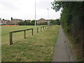
Footpath beside Chestfield Rugby ground
This path leads from the club pavilion and Sainsbury's Supermarket (behind hedge on right), to Primrose Way.
Image: © David Anstiss
Taken: 1 Aug 2009
0.19 miles