
IMAGES TAKEN NEAR TO
Thanet Way, WHITSTABLE, CT5 3JB
Introduction
This page details the photographs taken nearby to Thanet Way, CT5 3JB by members of the Geograph project.
The Geograph project started in 2005 with the aim of publishing, organising and preserving representative images for every square kilometre of Great Britain, Ireland and the Isle of Man.

There are currently over 7.5m images from over14,400 individuals and you can help contribute to the project by visiting https://www.geograph.org.uk
Image Map
Images are licensed for reuse under creativecommons.org/licenses/by-sa/2.0
Notes
- Clicking on the map will re-center to the selected point.
- The higher the marker number, the further away the image location is from the centre of the postcode.
Image Listing (48 Images Found)
Images are licensed for reuse under creativecommons.org/licenses/by-sa/2.0
Image
Details
Distance
1

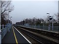
Chestfield & Swalecliffe station
View NE, towards Margate and Ramsgate (right), Whitstable, Chatham and London (left: ex-SE&C Kent Coast main line). The scene is from the main A299, before the by-pass was built.
Image: © Ben Brooksbank
Taken: 5 May 1985
0.01 miles
3
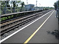
Chestfield and Swalecliffe railway station, Kent
Opened in 1930 by the Southern Railway on its line from Chatham to Margate, this station is of lightweight construction to minimise weight, as it is situated on an embankment above the coastal landscape. View west towards Faversham and Chatham.
Image: © Nigel Thompson
Taken: 25 Jul 2012
0.02 miles
4
TV Monitor, Chestfield & Swale Cliffe Station
Image: © N Chadwick
Taken: 4 Jul 2009
0.02 miles
5
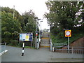
Chestfield and Swalecliffe railway station
Image: © Stacey Harris
Taken: 15 Oct 2010
0.02 miles
6
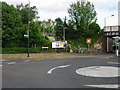
Pedestrian access to Chestfield and Swalecliffe railway station
The mini roundabout is at the junction of Herne Bay Road and St John's Road
Image: © Nick Smith
Taken: 20 May 2008
0.02 miles
7
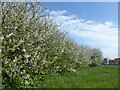
Blossom alongside Thanet Way
This view is standing by the railway bridge to the west of Chestfield & Swalecliffe station.
Image: © Marathon
Taken: 28 Mar 2017
0.03 miles
8
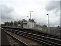
Chestfield and Swalecliffe railway station
Image: © Stacey Harris
Taken: 15 Oct 2010
0.03 miles
10
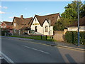
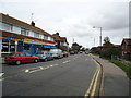
Swalecliffe - the former church hall
Now the premises of a property letting agency, but originally the local church hall, and the location (on the right-hand gable end) of Image
Image: © Richard Law
Taken: 17 Aug 2014
0.04 miles