IMAGES TAKEN NEAR TO
Wraik Hill, WHITSTABLE, CT5 3BY
Introduction
This page details the photographs taken nearby to Wraik Hill, CT5 3BY by members of the Geograph project.
The Geograph project started in 2005 with the aim of publishing, organising and preserving representative images for every square kilometre of Great Britain, Ireland and the Isle of Man.

There are currently over 7.5m images from over14,400 individuals and you can help contribute to the project by visiting https://www.geograph.org.uk
Image Map
Images are licensed for reuse under creativecommons.org/licenses/by-sa/2.0
Notes
- Clicking on the map will re-center to the selected point.
- The higher the marker number, the further away the image location is from the centre of the postcode.
Image Listing (12 Images Found)
Images are licensed for reuse under creativecommons.org/licenses/by-sa/2.0
Image
Details
Distance
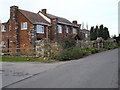
1
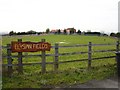
Wraik Hill Farmhouse
On Wraik Hill, close to Brookfield Farm.
Image: © David Anstiss
Taken: 25 Apr 2010
0.03 miles
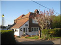
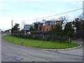
2
Windy Ridge
This guest house on Wraik Hill has an extraordinary stone wall on its road frontage, incorporating several arches. The house also has stone cornices. Their website says "...originally a pair of farm cottages, the house was rebuilt and extended using reclaimed timber and stone to create an unusual building of unique character."
Image: © Penny Mayes
Taken: 15 Feb 2007
0.05 miles
4
Water Reservoir on Wraik Hill
Close to Brookfield Farm.
Image: © David Anstiss
Taken: 25 Apr 2010
0.09 miles
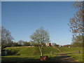
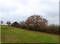
6
View from the bridleway on Wraik Hill
Looking southwards over Bluebell Farm. Ellenden Wood is in the background.
Image: © David Anstiss
Taken: 25 Apr 2010
0.21 miles
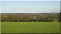
7
View from Wraik Hill
Not great on this occasion as the cloud had come down but a good view across Seasalter Levels to the Swale with the Isle of Sheppey on the right and the Medway with its two power stations gently smoking in the distance, about 18 miles away. I'm told they get great sunsets here, I believe J M W Turner liked them too.
Image: © Penny Mayes
Taken: 15 Feb 2007
0.22 miles
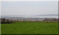
8
Wraik Hill Nature Reserve, near Whitstable
Looking south-west from the slopes above the A299, known as the Thanet Way, and Seasalter.
Image: © pam fray
Taken: 28 Nov 2017
0.22 miles
9
House on Wraik Hill
Plainly designed to make the most of its wonderful view up the Swale and across the Isle of Sheppey.
Image: © Penny Mayes
Taken: 15 Feb 2007
0.23 miles
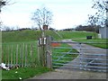
10
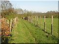
Bridleway on Wraik Hill
This track leads around a water reservoir and radio transmitter and head towards Clapham Hill on the A290.
Image: © David Anstiss
Taken: 25 Apr 2010
0.23 miles