IMAGES TAKEN NEAR TO
Ellis Road, WHITSTABLE, CT5 2AX
Introduction
This page details the photographs taken nearby to Ellis Road, CT5 2AX by members of the Geograph project.
The Geograph project started in 2005 with the aim of publishing, organising and preserving representative images for every square kilometre of Great Britain, Ireland and the Isle of Man.

There are currently over 7.5m images from over14,400 individuals and you can help contribute to the project by visiting https://www.geograph.org.uk
Image Map
Images are licensed for reuse under creativecommons.org/licenses/by-sa/2.0
Notes
- Clicking on the map will re-center to the selected point.
- The higher the marker number, the further away the image location is from the centre of the postcode.
Image Listing (108 Images Found)
Images are licensed for reuse under creativecommons.org/licenses/by-sa/2.0
Image
Details
Distance
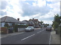
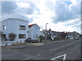
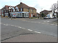
2
Looking east-northeast across Pier Avenue
Planning permission has been granted by Canterbury City Council under application number CA//15/02524 for the “demolition of existing store and garage and erection of detached bungalow with associated parking”. The location is described as land to the rear of 208, Tankerton Road and this view shows the store and garage mentioned in the application. Number 208 can also be seen in Image
Image: © John Baker
Taken: 6 Mar 2016
0.07 miles
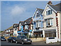
3
Pier Avenue
The west side, south of Tankerton Road.
Image: © Mike Quinn
Taken: 21 Sep 2016
0.07 miles
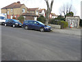
4
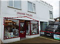
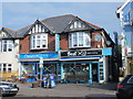
Crossed Threads, Tankerton
In Tankerton Road, near Ellis Road. The shop has displays of poppies outside and one of their windows devoted to Kent soldiers who died in World War I.
Image: © pam fray
Taken: 6 Nov 2018
0.07 miles
5
Looking southeast across Tankerton Road
Towards 208, Tankerton Road, which is also on the corner of Pier Avenue. Planning permission has been granted by Canterbury City Council under application number CA//15/02524 for the “demolition of existing store and garage and erection of detached bungalow with associated parking”. The location is described as land to the rear of 208, Tankerton Road. The store and garage mentioned in the application can be seen in this view of Image
Image: © John Baker
Taken: 6 Mar 2016
0.07 miles
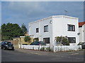
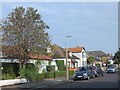
6
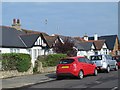
Pier Avenue
The west side, north of Northwood Road.
Image: © Mike Quinn
Taken: 21 Sep 2016
0.07 miles