IMAGES TAKEN NEAR TO
Cromwell Road, WHITSTABLE, CT5 1NH
Introduction
This page details the photographs taken nearby to Cromwell Road, CT5 1NH by members of the Geograph project.
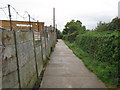
The Geograph project started in 2005 with the aim of publishing, organising and preserving representative images for every square kilometre of Great Britain, Ireland and the Isle of Man.

There are currently over 7.5m images from over14,400 individuals and you can help contribute to the project by visiting https://www.geograph.org.uk
Image Map
Images are licensed for reuse under creativecommons.org/licenses/by-sa/2.0
Notes
- Clicking on the map will re-center to the selected point.
- The higher the marker number, the further away the image location is from the centre of the postcode.
Image Listing (244 Images Found)
Images are licensed for reuse under creativecommons.org/licenses/by-sa/2.0
Image
Details
Distance
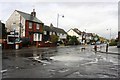
1
Wheelbarrows in Whitstable
Looking north along Cromwell Road. The barrows are displayed outside Stocks of Whitstable, hardware store.
Image: © pam fray
Taken: 15 Mar 2023
0.02 miles
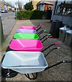
2

Wheelbarrows in Whitstable
The barrows are displayed outside Stocks of Whitstable, hardware store in Cromwell Road..
Image: © pam fray
Taken: 15 Mar 2023
0.02 miles
3
Steam Walk 2, Whitstable
Work on the "stream" is still in progress
Image: © Robert Eva
Taken: 9 Nov 2017
0.02 miles
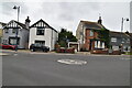
4
Stream Walk towards Hamilton Road
This footpath leads from Cromwell Walk (the other side of the railway), towards Stream Walk (road, near Whitstable High Street). Most of it is used by the Crab and Winkle Way (cycle route).
Image: © David Anstiss
Taken: 5 Oct 2010
0.02 miles
5

Whitstable mural
On the concrete wall near the southern end of Stream Walk, so called because the Gorrell Stream once flowed beneath it. In the 1920s, a long stretch of it was culverted and a large harbour reservoir was constructed. This was concreted over in the 1960s and is now the Gorrell Tank car park, next to the harbour.
Image: © pam fray
Taken: 21 Dec 2022
0.02 miles
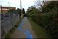
6
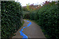
Stream Walk, Whitstable
Complete with the "stream" painted on it.
Image: © Robert Eva
Taken: 9 Nov 2017
0.03 miles

8

Whitstable mural
Detail of a mural on the concrete wall near the southern end of Stream Walk, so called because the Gorrell Stream once flowed beneath it. In the 1920s, a long stretch of it was culverted and a large harbour reservoir was constructed. This was concreted over in the 1960s and is now the Gorrell Tank car park, next to the harbour.
Image: © pam fray
Taken: 21 Dec 2022
0.03 miles