IMAGES TAKEN NEAR TO
Horsebridge Road, WHITSTABLE, CT5 1BU

Introduction

This page details the photographs taken nearby to Horsebridge Road, CT5 1BU by members of the Geograph project.

The Geograph project started in 2005 with the aim of publishing, organising and preserving representative images for every square kilometre of Great Britain, Ireland and the Isle of Man.

There are currently over 7.5m images from over14,400 individuals and you can help contribute to the project by visiting https://www.geograph.org.uk

Image Map


Images are licensed for reuse under creativecommons.org/licenses/by-sa/2.0
Notes
  • Clicking on the map will re-center to the selected point.
  • The higher the marker number, the further away the image location is from the centre of the postcode.

Image Listing (854 Images Found)

Images are licensed for reuse under creativecommons.org/licenses/by-sa/2.0
  • ...
Image
Details
Distance
1
Telephone Box near Zizzi, Whitstable
Beside Sea Street. Zizzi is a restaurant/bar as part of Brownings Yard complex of buildings.
Image: © David Anstiss Taken: 13 Oct 2012
0.01 miles
2
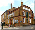
Royal Native Oyster Stores
Whitstable has long been associated oysters and this building is now a restaurant, indeed it has been an eating place for many years. It also bears the signage of the Royal Freefishers and Dredgers incorporated 1793. The building is designated by English Heritage as a Grade II listed building
Image: © Richard Hoare Taken: 25 Sep 2014
0.01 miles
3
The Prince Albert, Whitstable
Image: © Chris Whippet Taken: 5 May 2014
0.02 miles
4
Whitstable: Sea Wall
A narrow street which indeed runs alongside the seafront, though it is behind the houses on the left. The attractive weatherboarding catches the sun quite strikingly.
Image: © Chris Downer Taken: 9 Jul 2011
0.02 miles
5
Sea Wall, Whitstable
Image: © Chris Whippet Taken: 5 May 2014
0.02 miles
6
The Prince Albert
A pub on the corner of Sea Street and Red Lion Lane, Whitstable.
Image: © Stephen Craven Taken: 24 Jul 2010
0.02 miles
7
Chimney of the Prince Albert
A detail of one of the chimneys of the pub. See Image
Image: © Stephen Craven Taken: 24 Jul 2010
0.02 miles
8
The Prince Albert, Whitstable
Image: © Chris Whippet Taken: 31 May 2016
0.02 miles
9
Royal Native Oyster Stores, Whitstable
Oyster production in Whitstable goes back even further, to Roman times. The Royal Native Oyster Stores was built by the Whitstable Oyster Company in 1893, to provide a place for sorting, grading and packing oysters as well as providing a large meeting room. It now houses a seafood restaurant. Most of the building dates from the 1890s, but some of the ground floor brickwork probably remains from an earlier building of 1793. The east gable has the legend “Royal Free Fishers and Dredgers incorporated 1793” and a first-floor loading door. The building is designated by English Heritage as a Grade II listed building (https://historicengland.org.uk/listing/the-list/list-entry/1084921 National Heritage List for England).
Image: © David Dixon Taken: 16 May 2013
0.02 miles
10
Sea Wall, Whitstable
Sea Wall is the name given to this narrow street, characteristic of the town.
Image: © Stephen McKay Taken: 26 May 2008
0.02 miles
  • ...