IMAGES TAKEN NEAR TO
Leggetts Lane, WHITSTABLE, CT5 1AW

Introduction

This page details the photographs taken nearby to Leggetts Lane, CT5 1AW by members of the Geograph project.

The Geograph project started in 2005 with the aim of publishing, organising and preserving representative images for every square kilometre of Great Britain, Ireland and the Isle of Man.

There are currently over 7.5m images from over14,400 individuals and you can help contribute to the project by visiting https://www.geograph.org.uk

Image Map


Images are licensed for reuse under creativecommons.org/licenses/by-sa/2.0
Notes
  • Clicking on the map will re-center to the selected point.
  • The higher the marker number, the further away the image location is from the centre of the postcode.

Image Listing (886 Images Found)

Images are licensed for reuse under creativecommons.org/licenses/by-sa/2.0
  • ...
Image
Details
Distance
1
Harbour Street, Whitstable
A variety of small shops in a variety of old buildings.
Image: © Des Blenkinsopp Taken: 20 Aug 2011
0.00 miles
2
Harbour Street Whitstable
Image: © Steve Fareham Taken: 23 Apr 2016
0.00 miles
3
Quba and Co Ltd Shop in Harbour Street Whitstable
The alleyway to the left is called Leggets Lane
Image: © PAUL FARMER Taken: 9 May 2009
0.01 miles
4
Quba & Co. Ltd
One of the many small shops along Harbour Street.
Image: © Des Blenkinsopp Taken: 20 Aug 2011
0.01 miles
5
Harbour Street, Whitstable
Image: © Christine Matthews Taken: 8 Oct 2016
0.01 miles
6
Harbour Street
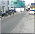
The building under construction, just beyond the blue car, forms part of a development called Courtyard Gardens. This view shows the Image that had been erected in September 2018 before any buildings had been erected.
Image: © John Baker Taken: 28 Sep 2019
0.01 miles
7
Whitstable: Harbour Street
More or less a continuation of the High Street, with shops on both sides.
Image: © Chris Downer Taken: 9 Jul 2011
0.01 miles
8
Harbour Street (2)
Image: © Mike Quinn Taken: 21 Sep 2016
0.01 miles
9
Leggett's Lane
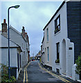
A lane so narrow as to be impassable by vehicles: more of an alleyway really. It links Sea Street and Harbour Street in Whitstable.
Image: © Stephen Craven Taken: 24 Jul 2010
0.01 miles
10
Sea Wall, Whitstable
Sea Wall is the name of the street, rather than a description of a structure.
Image: © Paul Harrop Taken: 20 Aug 2007
0.01 miles
  • ...