IMAGES TAKEN NEAR TO
Shottenden, CANTERBURY, CT4 8JX
Introduction
This page details the photographs taken nearby to CT4 8JX by members of the Geograph project.
The Geograph project started in 2005 with the aim of publishing, organising and preserving representative images for every square kilometre of Great Britain, Ireland and the Isle of Man.

There are currently over 7.5m images from over14,400 individuals and you can help contribute to the project by visiting https://www.geograph.org.uk
Image Map
Images are licensed for reuse under creativecommons.org/licenses/by-sa/2.0
Notes
- Clicking on the map will re-center to the selected point.
- The higher the marker number, the further away the image location is from the centre of the postcode.
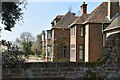
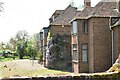
Image Listing (31 Images Found)
Images are licensed for reuse under creativecommons.org/licenses/by-sa/2.0
Image
Details
Distance
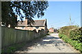
4
Farm Track near Howletts Farm
Off Soleshill Road.
Image: © Oast House Archive
Taken: 24 Jun 2010
0.05 miles

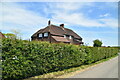
7
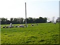
Dinner time!
This square is mostly orchards and woodland with a large arable field south of Soleshill Road but in the SE corner near Howletts Farm I found this pasture with ewes and lambs.
Image: © Penny Mayes
Taken: 14 Apr 2007
0.05 miles