IMAGES TAKEN NEAR TO
Knockwood Lane, CANTERBURY, CT4 8HN
Introduction
This page details the photographs taken nearby to Knockwood Lane, CT4 8HN by members of the Geograph project.
The Geograph project started in 2005 with the aim of publishing, organising and preserving representative images for every square kilometre of Great Britain, Ireland and the Isle of Man.

There are currently over 7.5m images from over14,400 individuals and you can help contribute to the project by visiting https://www.geograph.org.uk
Image Map
Images are licensed for reuse under creativecommons.org/licenses/by-sa/2.0
Notes
- Clicking on the map will re-center to the selected point.
- The higher the marker number, the further away the image location is from the centre of the postcode.
Image Listing (9 Images Found)
Images are licensed for reuse under creativecommons.org/licenses/by-sa/2.0
Image
Details
Distance
1
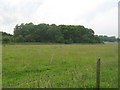
Knock Wood
As seen from Knockwood Lane.
Image: © David Anstiss
Taken: 28 Jun 2009
0.09 miles
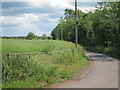
2
View from near Howlett's Farm
Brushdane Wood near Challock is in the distance towards the left.
Image: © Marathon
Taken: 29 Aug 2020
0.13 miles
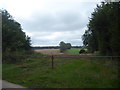
4
Lane junction by Howlett's Farm
It is only a byway to the left, although in a good state as far as the HGV entrance to Howlett's Farm.
Image: © Robin Webster
Taken: 2 Aug 2018
0.17 miles
5
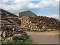
Log Pile's, Howlett's Farm
Beside Knockwood Lane, to the west of Molash.
Image: © Oast House Archive
Taken: 31 May 2011
0.18 miles
6
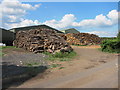
Log Pile's, Howlett's Farm
Beside Knockwood Lane, to the west of Molash.
Image: © Oast House Archive
Taken: 31 May 2011
0.18 miles
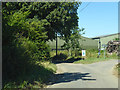
7
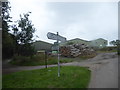
Meeting of lanes and paths
Howlett's Farm is ahead.
Image: © Marathon
Taken: 29 Aug 2020
0.18 miles
8
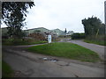
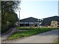
Howlett's Farm
This is at a meeting of lanes and paths.
Image: © Marathon
Taken: 29 Aug 2020
0.18 miles
9
Howlett's Farm
This is the other end of the right of way from Hegdale Farm http://www.geograph.org.uk/photo/402636 http://www.geograph.org.uk/photo/402648 http://www.geograph.org.uk/photo/402659 . The unnamed road on the right sweeps round behind Molash church to join up with Shottenden Road.
Image: © Penny Mayes
Taken: 14 Apr 2007
0.21 miles