IMAGES TAKEN NEAR TO
Mulberry Hill, CANTERBURY, CT4 8AH
Introduction
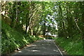
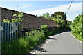
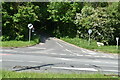
This page details the photographs taken nearby to Mulberry Hill, CT4 8AH by members of the Geograph project.
The Geograph project started in 2005 with the aim of publishing, organising and preserving representative images for every square kilometre of Great Britain, Ireland and the Isle of Man.

There are currently over 7.5m images from over14,400 individuals and you can help contribute to the project by visiting https://www.geograph.org.uk
Image Map
Images are licensed for reuse under creativecommons.org/licenses/by-sa/2.0
Notes
- Clicking on the map will re-center to the selected point.
- The higher the marker number, the further away the image location is from the centre of the postcode.
Image Listing (104 Images Found)
Images are licensed for reuse under creativecommons.org/licenses/by-sa/2.0
Image
Details
Distance
8
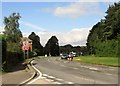
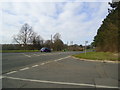
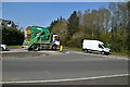
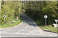
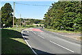
Bagham A28 A252 junction
The A28 Ashford Canterbury road is joined here by the A252 from Maidstone and the A28 has to give way! Temporary lights at the moment due to building work alongside the road
Image: © Martin Dawes
Taken: 14 Aug 2015
0.10 miles