IMAGES TAKEN NEAR TO
Cockering Road, CANTERBURY, CT4 7LG
Introduction
This page details the photographs taken nearby to Cockering Road, CT4 7LG by members of the Geograph project.
The Geograph project started in 2005 with the aim of publishing, organising and preserving representative images for every square kilometre of Great Britain, Ireland and the Isle of Man.

There are currently over 7.5m images from over14,400 individuals and you can help contribute to the project by visiting https://www.geograph.org.uk
Image Map (Loading...)


Getting Data...Please wait
Leaflet Map data © OpenStreetMap
Images are licensed for reuse under creativecommons.org/licenses/by-sa/2.0
Notes
- Clicking on the map will re-center to the selected point.
- The higher the marker number, the further away the image location is from the centre of the postcode.
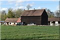
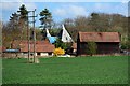
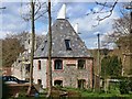
Image Listing (42 Images Found)
Images are licensed for reuse under creativecommons.org/licenses/by-sa/2.0
Image
Details
Distance

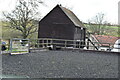
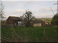
4
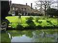
House on the banks of the Great Stour, Horton
Image: © Nick Smith
Taken: 26 Apr 2008
0.04 miles
7
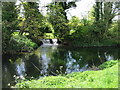
Small weir feeding into the Great Stour at Horton
Image: © Nick Smith
Taken: 26 Apr 2008
0.05 miles
8
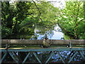
View from the bridge over the Great Stour at Horton
The bridge was fairly derelict
Image: © Nick Smith
Taken: 26 Apr 2008
0.06 miles
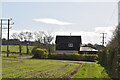
9
Horton Bungalows
As seen from a footpath from Thanington towards Chartham. Houses near Horton Manor.
Image: © David Anstiss
Taken: 11 Apr 2010
0.06 miles