IMAGES TAKEN NEAR TO
Crundale, CANTERBURY, CT4 7ED
Introduction
This page details the photographs taken nearby to CT4 7ED by members of the Geograph project.
The Geograph project started in 2005 with the aim of publishing, organising and preserving representative images for every square kilometre of Great Britain, Ireland and the Isle of Man.

There are currently over 7.5m images from over14,400 individuals and you can help contribute to the project by visiting https://www.geograph.org.uk
Image Map
Images are licensed for reuse under creativecommons.org/licenses/by-sa/2.0
Notes
- Clicking on the map will re-center to the selected point.
- The higher the marker number, the further away the image location is from the centre of the postcode.
Image Listing (30 Images Found)
Images are licensed for reuse under creativecommons.org/licenses/by-sa/2.0
Image
Details
Distance
1
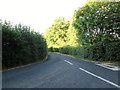
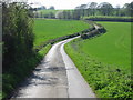
Road to Sole Street Crundale
It is a minor road off a minor road all have passing places
Image: © Martin Dawes
Taken: 9 Aug 2015
0.02 miles
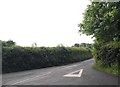
3
Lane junction near Crundale
A lane from Sole Street, heads left into Crundale or right towards Godmersham.
Image: © David Anstiss
Taken: 21 Mar 2010
0.04 miles
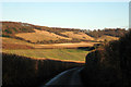
4
Lane towards Winchcombe Farm
This unnamed lane leads from Crundale towards the farm then onwards to Sole Street. In the background is Eggringe Wood.
Image: © David Anstiss
Taken: 21 Mar 2010
0.10 miles

8
Footpath to Thornham Shaw
This rectangular piece of woodland is near Thornham Lodge in Crundale.
The path leads from Purr Wood.
Image: © David Anstiss
Taken: 21 Mar 2010
0.16 miles
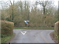
9
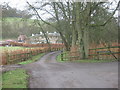
Driveway to the Old Rectory
On a lane leading towards Crundale. Viney's Wood is in the background.
Image: © David Anstiss
Taken: 21 Mar 2010
0.17 miles
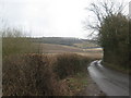
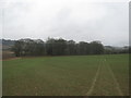
10
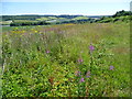
Rosebay willowherb and ragwort above the valley of the Great Stour
On a beautiful summer's day, this field is alongside the road to Crundale, which is beyond the hedge on the right. The view looks in the opposite direction from the valley of the Great Stour. The Stour Valley Walk passes along the bottom of the valley ahead, while Eggringe Wood is on the far side of the valley.
Image: © Marathon
Taken: 10 Jul 2015
0.18 miles