IMAGES TAKEN NEAR TO
New House Lane, CANTERBURY, CT4 7BN
Introduction
This page details the photographs taken nearby to New House Lane, CT4 7BN by members of the Geograph project.
The Geograph project started in 2005 with the aim of publishing, organising and preserving representative images for every square kilometre of Great Britain, Ireland and the Isle of Man.

There are currently over 7.5m images from over14,400 individuals and you can help contribute to the project by visiting https://www.geograph.org.uk
Image Map
Images are licensed for reuse under creativecommons.org/licenses/by-sa/2.0
Notes
- Clicking on the map will re-center to the selected point.
- The higher the marker number, the further away the image location is from the centre of the postcode.
Image Listing (16 Images Found)
Images are licensed for reuse under creativecommons.org/licenses/by-sa/2.0
Image
Details
Distance
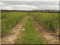
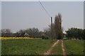
1
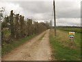
Access road from Upper Horton Farm
This road leads from the farm, past the farm cottages towards New House Lane.
Hand Wood is in the background.
Image: © David Anstiss
Taken: 11 Apr 2010
0.05 miles
2
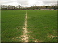
Footpath towards Larkey Valley Wood
A path from Chartham Downs Road, leads past Upper Horton Farm towards the wood close to New House Lane.
Image: © David Anstiss
Taken: 11 Apr 2010
0.05 miles
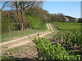
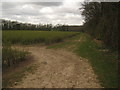
3
Footpath to Upper Horton Farm
A path from New House Lane, near a bridleway to Larkey Valley Wood, leads towards the farm, then onwards to Long Shaw and towards Chartham Downs Road.
Image: © David Anstiss
Taken: 11 Apr 2010
0.09 miles
4
Upper Horton Farm farm road
A road from New House Lane leads towards the farm.
Image: © David Anstiss
Taken: 11 Apr 2010
0.10 miles
5
Upper Horton Farm fruit field
A path from Chartham Downs Road leads through Long Shaw into this large redcurrant bush field, before heading towards New House Lane. This view through the field looks toward New House Lane (in the trees in the background).
Image: © David Anstiss
Taken: 11 Apr 2010
0.12 miles
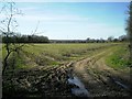
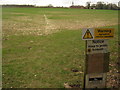
7
Fruit Orchard
On footpath from New House Lane.
Image: © Oast House Archive
Taken: 8 Apr 2011
0.19 miles
9
Cottage at Upper Horton Farm
On a track leading to Upper Horton Farm - this cottage is just before the farm, surrounded by fields of oilseed rape.
Image: © O O'Brien
Taken: 14 Apr 2007
0.20 miles
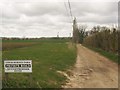
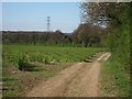
10
Footpath and bridleway junction near Upper Horton Farm (2)
A bridleway from New House Lane heads straight on towards Larkey Valley Wood (in the background) and Cockering Road. A footpath heads left towards Upper Horton Farm and Chartham Downs Road.
Image: © David Anstiss
Taken: 11 Apr 2010
0.21 miles