IMAGES TAKEN NEAR TO
Stelling Minnis, CANTERBURY, CT4 6BN
Introduction
This page details the photographs taken nearby to CT4 6BN by members of the Geograph project.
The Geograph project started in 2005 with the aim of publishing, organising and preserving representative images for every square kilometre of Great Britain, Ireland and the Isle of Man.

There are currently over 7.5m images from over14,400 individuals and you can help contribute to the project by visiting https://www.geograph.org.uk
Image Map
Images are licensed for reuse under creativecommons.org/licenses/by-sa/2.0
Notes
- Clicking on the map will re-center to the selected point.
- The higher the marker number, the further away the image location is from the centre of the postcode.
Image Listing (7 Images Found)
Images are licensed for reuse under creativecommons.org/licenses/by-sa/2.0
Image
Details
Distance
1
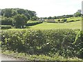
Looking west from a country lane
Towards Fryarne Park Farm (on the left) and Apple Tree Cottage (to its right). A white triangle, behind the cottage, is part of an array of solar panels.
Image: © John Baker
Taken: 3 Aug 2014
0.01 miles
2
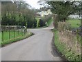
Fryarne Park on sharp bend, Pett Bottom Road
Photograph 1 in a series of 4 following the road to Stelling Minnis
Image: © Nick Smith
Taken: 4 Feb 2007
0.01 miles
3
Pett Bottom road as it starts to climb towards Stelling Minnis
Photograph 2 in a series of 4 following the road to Stelling Minnis
Image: © Nick Smith
Taken: 4 Feb 2007
0.08 miles
4
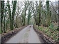
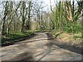
Passing through Lodge Wood
Photograph 3 in a series of 4 following the road to Stelling Minnis
Image: © Nick Smith
Taken: 4 Feb 2007
0.14 miles
5
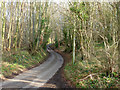
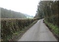
Lane through Fryarne Park Wood
Ascending quite a steep hill.
Image: © Robin Webster
Taken: 28 Dec 2015
0.19 miles
6
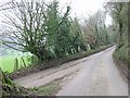
Junction with another minor road to the E
Photograph 4 in a series of 4 following the road to Stelling Minnis.
Image: © Nick Smith
Taken: 4 Feb 2007
0.21 miles