IMAGES TAKEN NEAR TO
Crown Lane, CANTERBURY, CT4 6AT
Introduction
This page details the photographs taken nearby to Crown Lane, CT4 6AT by members of the Geograph project.
The Geograph project started in 2005 with the aim of publishing, organising and preserving representative images for every square kilometre of Great Britain, Ireland and the Isle of Man.

There are currently over 7.5m images from over14,400 individuals and you can help contribute to the project by visiting https://www.geograph.org.uk
Image Map
Images are licensed for reuse under creativecommons.org/licenses/by-sa/2.0
Notes
- Clicking on the map will re-center to the selected point.
- The higher the marker number, the further away the image location is from the centre of the postcode.
Image Listing (11 Images Found)
Images are licensed for reuse under creativecommons.org/licenses/by-sa/2.0
Image
Details
Distance
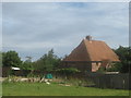
6
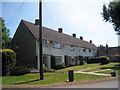
Terraced Housing at Stelling Minnis
Image: © Oast House Archive
Taken: 4 Jul 2009
0.15 miles
8
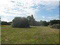
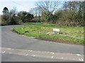
Stelling Minnis Common
Open ground near Bossingham Lane.
Image: © David Anstiss
Taken: 18 Jul 2010
0.18 miles
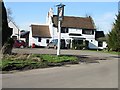
9
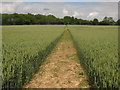
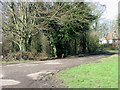
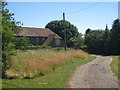
Footpath towards Crown Lane
This path leads from the B2068 Stone Street near Curtis Lane, towards a lane (leading towards Image) in Stelling Minnis.
Image: © David Anstiss
Taken: 20 Jun 2010
0.20 miles