IMAGES TAKEN NEAR TO
Maypole Lane, CANTERBURY, CT3 4LJ
Introduction
This page details the photographs taken nearby to Maypole Lane, CT3 4LJ by members of the Geograph project.
The Geograph project started in 2005 with the aim of publishing, organising and preserving representative images for every square kilometre of Great Britain, Ireland and the Isle of Man.

There are currently over 7.5m images from over14,400 individuals and you can help contribute to the project by visiting https://www.geograph.org.uk
Image Map
Images are licensed for reuse under creativecommons.org/licenses/by-sa/2.0
Notes
- Clicking on the map will re-center to the selected point.
- The higher the marker number, the further away the image location is from the centre of the postcode.
Image Listing (25 Images Found)
Images are licensed for reuse under creativecommons.org/licenses/by-sa/2.0
Image
Details
Distance
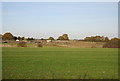
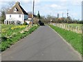
2
Forge House, Maypole
On Maypole Road. Opposite a footpath to Beacon Wood.
Image: © David Anstiss
Taken: 25 Apr 2010
0.11 miles
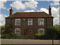
7
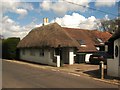
Hawthorn Cottage
Thatched Cottage on Maypole with tiled extension.
Image: © David Anstiss
Taken: 25 Apr 2010
0.14 miles
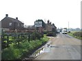
8
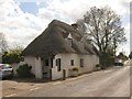
Pear Tree Cottage
Thatched Cottage on Maypole Road.
Image: © David Anstiss
Taken: 25 Apr 2010
0.16 miles
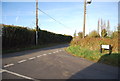
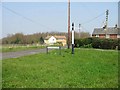
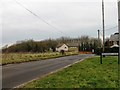
10
Looking W along Old Tree Road towards Maypole
Image: © Nick Smith
Taken: 18 Mar 2007
0.19 miles