IMAGES TAKEN NEAR TO
Canterbury Industrial Park, Island Road, CANTERBURY, CT3 4HQ
Introduction
This page details the photographs taken nearby to Canterbury Industrial Park, Island Road, CT3 4HQ by members of the Geograph project.
The Geograph project started in 2005 with the aim of publishing, organising and preserving representative images for every square kilometre of Great Britain, Ireland and the Isle of Man.

There are currently over 7.5m images from over14,400 individuals and you can help contribute to the project by visiting https://www.geograph.org.uk
Image Map
Images are licensed for reuse under creativecommons.org/licenses/by-sa/2.0
Notes
- Clicking on the map will re-center to the selected point.
- The higher the marker number, the further away the image location is from the centre of the postcode.
Image Listing (20 Images Found)
Images are licensed for reuse under creativecommons.org/licenses/by-sa/2.0
Image
Details
Distance
1
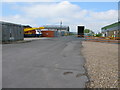
Small industrial estate off Island Road, Hersden
Image: © Nick Smith
Taken: 2 Jun 2010
0.02 miles
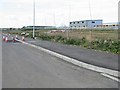
2
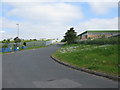
Road from industrial estate towards Island Road
Image: © Nick Smith
Taken: 2 Jun 2010
0.03 miles
3
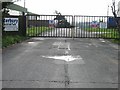
Canterbury Industrial Park - closed on Sunday
Image: © Nick Smith
Taken: 18 Mar 2007
0.11 miles
4
Road from the Canterbury Industrial Park to Island Road
Image: © Nick Smith
Taken: 18 Mar 2007
0.15 miles
5
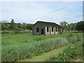
Derelict building beside Great Stour
Below Canterbury Industrial Park.
Beside a marsh drain leading from Westbere Marshes towards the Great Stour.
Image: © David Anstiss
Taken: 23 May 2011
0.15 miles
6
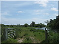
Gate beside Great Stour
This farm gate is on a footpath beside the river.
Image: © David Anstiss
Taken: 23 May 2011
0.16 miles
7
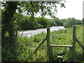
Stile near Great Stour
On a footpath beside the river from Port Farm.
Image: © David Anstiss
Taken: 23 May 2011
0.18 miles
8
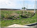
As yet undeveloped land at the Lakesview International Business Park
Image: © Nick Smith
Taken: 18 Mar 2007
0.18 miles
9
The back of Lakesview International Business Park
Image: © Nick Smith
Taken: 18 Mar 2007
0.18 miles
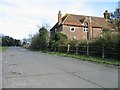
10
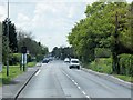
Hersden, Island Road (A28)
Between Sarre and Canterbury, the A28 follows the line of an early Roman road.
Image: © David Dixon
Taken: 16 May 2013
0.19 miles