IMAGES TAKEN NEAR TO
Stodmarsh, CANTERBURY, CT3 4BA
Introduction
This page details the photographs taken nearby to CT3 4BA by members of the Geograph project.
The Geograph project started in 2005 with the aim of publishing, organising and preserving representative images for every square kilometre of Great Britain, Ireland and the Isle of Man.

There are currently over 7.5m images from over14,400 individuals and you can help contribute to the project by visiting https://www.geograph.org.uk
Image Map
Images are licensed for reuse under creativecommons.org/licenses/by-sa/2.0
Notes
- Clicking on the map will re-center to the selected point.
- The higher the marker number, the further away the image location is from the centre of the postcode.
Image Listing (67 Images Found)
Images are licensed for reuse under creativecommons.org/licenses/by-sa/2.0
Image
Details
Distance

4
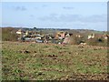
Stodmarsh
The village is in the distance. The blue label on the sign indicates National Cycle Route 1 goes that way.
Image: © Robin Webster
Taken: 4 Jun 2015
0.03 miles
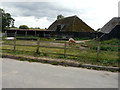
5
View over Stodmarsh village from Hollybush Lane.
Taken from outside the grid square.
Image: © Nick Smith
Taken: 21 Jan 2007
0.05 miles
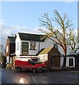
6
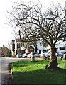
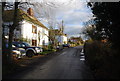
'The Red Lion', Stodmarsh
'The Red Lion' stands opposite the small village green part of which can be seen here.
Image: © David Kemp
Taken: 14 Jan 2007
0.07 miles