IMAGES TAKEN NEAR TO
Ash Road, CANTERBURY, CT3 3DG
Introduction
This page details the photographs taken nearby to Ash Road, CT3 3DG by members of the Geograph project.
The Geograph project started in 2005 with the aim of publishing, organising and preserving representative images for every square kilometre of Great Britain, Ireland and the Isle of Man.

There are currently over 7.5m images from over14,400 individuals and you can help contribute to the project by visiting https://www.geograph.org.uk
Image Map
Images are licensed for reuse under creativecommons.org/licenses/by-sa/2.0
Notes
- Clicking on the map will re-center to the selected point.
- The higher the marker number, the further away the image location is from the centre of the postcode.
Image Listing (50 Images Found)
Images are licensed for reuse under creativecommons.org/licenses/by-sa/2.0
Image
Details
Distance
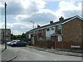
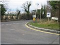
3
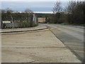
Junction of Wilcox Close and Cooting Road.
The B2046 junction with Cooting Road also visible.
Image: © Nick Smith
Taken: 28 Jan 2007
0.03 miles
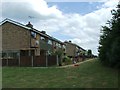
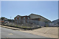
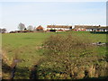
4
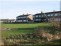
Houses on Ash Road overlooking playing field
Image: © Nick Smith
Taken: 11 Jan 2009
0.04 miles
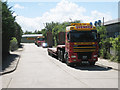
7
Premises on Aylesham industrial estate
Mutley Plant Service Ltd.
Image: © Robin Webster
Taken: 29 Jun 2019
0.05 miles
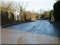
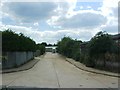
10
Junction of Cooting Road with the B2046
Image: © Nick Smith
Taken: 28 Jan 2007
0.07 miles