IMAGES TAKEN NEAR TO
Clarendon Road, CANTERBURY, CT3 3AQ
Introduction
This page details the photographs taken nearby to Clarendon Road, CT3 3AQ by members of the Geograph project.
The Geograph project started in 2005 with the aim of publishing, organising and preserving representative images for every square kilometre of Great Britain, Ireland and the Isle of Man.

There are currently over 7.5m images from over14,400 individuals and you can help contribute to the project by visiting https://www.geograph.org.uk
Image Map
Images are licensed for reuse under creativecommons.org/licenses/by-sa/2.0
Notes
- Clicking on the map will re-center to the selected point.
- The higher the marker number, the further away the image location is from the centre of the postcode.
Image Listing (85 Images Found)
Images are licensed for reuse under creativecommons.org/licenses/by-sa/2.0
Image
Details
Distance
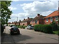
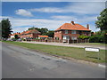
1
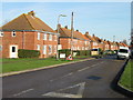
View along Clarendon Road from Dorman Avenue South
Image: © Nick Smith
Taken: 11 Jan 2009
0.06 miles
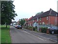
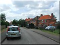
2
Houses on Clarendon Road, Aylesham
The village here was built in the 1920s to serve Kent coal mines, as it turned out only Snowdown, as other planned mines nearby never opened.
Image: © Robin Webster
Taken: 4 Jun 2015
0.06 miles
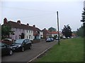
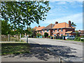
9
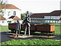
Commemorative statue showing Aylesham's history of mining
Image: © Nick Smith
Taken: 14 Jan 2007
0.10 miles
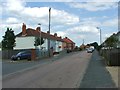
10
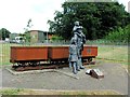
Payday at Snowdown Colliery. Aylesham
Sculpture commemorating Aylesham's mining history.
Image: © Chris Whippet
Taken: 21 Jun 2015
0.10 miles