IMAGES TAKEN NEAR TO
Saunders Lane, CANTERBURY, CT3 2SH
Introduction
This page details the photographs taken nearby to Saunders Lane, CT3 2SH by members of the Geograph project.
The Geograph project started in 2005 with the aim of publishing, organising and preserving representative images for every square kilometre of Great Britain, Ireland and the Isle of Man.

There are currently over 7.5m images from over14,400 individuals and you can help contribute to the project by visiting https://www.geograph.org.uk
Image Map
Images are licensed for reuse under creativecommons.org/licenses/by-sa/2.0
Notes
- Clicking on the map will re-center to the selected point.
- The higher the marker number, the further away the image location is from the centre of the postcode.
Image Listing (20 Images Found)
Images are licensed for reuse under creativecommons.org/licenses/by-sa/2.0
Image
Details
Distance
1
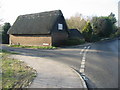
Thatched property on the junction of Saunders Lane and Sandwich Road
Image: © Nick Smith
Taken: 31 Jan 2009
0.01 miles
2
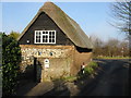
Thatched property on junction of Saunders Lane with Sandwich Road
Image: © Nick Smith
Taken: 31 Jan 2009
0.02 miles
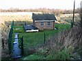
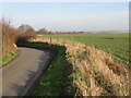
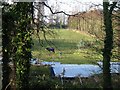
4
Land between the old Sandwich Road and the new A257
A small stream runs through this little valley between the two roads.
Image: © Nick Smith
Taken: 31 Jan 2009
0.04 miles
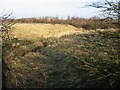
6
Footpath across field from Saunders Lane
Image: © Nick Smith
Taken: 31 Jan 2009
0.09 miles
7
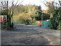
Entrance to Saunders Nursery on Saunders Lane
Image: © Nick Smith
Taken: 31 Jan 2009
0.09 miles
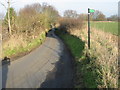
8
Looking W towards Ash from Saunders Lane
Image: © Nick Smith
Taken: 31 Jan 2009
0.09 miles
9
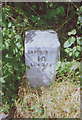
Old Milestone by the A257, Sandwich Road, near Ash
Carved stone post by the A257, in parish of Ash (Dover District), Sandwich Road, just East of junction with old Sandwich road, in hedge behind footpath, on North side of road. Sandwich limestone block, erected by the Canterbury & Sandwich turnpike trust in the 19th century.
Inscription reads:-
: SANDWICH / 2 / DEAL / 8 : : CANTERBURY / 10 / LONDON / 66 :
Kent HER.
HER Number: TR 25 NE 258 https://www.heritagegateway.org.uk/Gateway/Results_Single.aspx?uid=MKE78248&resourceID=1005
Milestone Society National ID: KE_LQ66
Image: © C Woodward
Taken: 7 Aug 2008
0.10 miles