IMAGES TAKEN NEAR TO
Warehorn Road, CANTERBURY, CT3 2ND
Introduction
This page details the photographs taken nearby to Warehorn Road, CT3 2ND by members of the Geograph project.
The Geograph project started in 2005 with the aim of publishing, organising and preserving representative images for every square kilometre of Great Britain, Ireland and the Isle of Man.

There are currently over 7.5m images from over14,400 individuals and you can help contribute to the project by visiting https://www.geograph.org.uk
Image Map
Images are licensed for reuse under creativecommons.org/licenses/by-sa/2.0
Notes
- Clicking on the map will re-center to the selected point.
- The higher the marker number, the further away the image location is from the centre of the postcode.
Image Listing (41 Images Found)
Images are licensed for reuse under creativecommons.org/licenses/by-sa/2.0
Image
Details
Distance
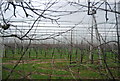
3
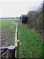
Footpath alongside a paddock
This path intersects the Stour Valley Walk (which we were supposed to be on but lost the path at Corner Drove!)
Image: © Nick Smith
Taken: 1 Jan 2008
0.04 miles
6
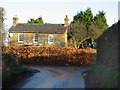
House at the junction of Knell Lane and Molland Lane
Image: © Nick Smith
Taken: 15 Jan 2007
0.05 miles
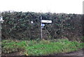
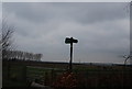
8
No through road
The maps say Molland Lane but the sign says Paramour Street Image
Image: © Nick Smith
Taken: 12 Dec 2007
0.07 miles