IMAGES TAKEN NEAR TO
Lower Goldstone, CANTERBURY, CT3 2DY
Introduction
This page details the photographs taken nearby to Lower Goldstone, CT3 2DY by members of the Geograph project.
The Geograph project started in 2005 with the aim of publishing, organising and preserving representative images for every square kilometre of Great Britain, Ireland and the Isle of Man.

There are currently over 7.5m images from over14,400 individuals and you can help contribute to the project by visiting https://www.geograph.org.uk
Image Map
Images are licensed for reuse under creativecommons.org/licenses/by-sa/2.0
Notes
- Clicking on the map will re-center to the selected point.
- The higher the marker number, the further away the image location is from the centre of the postcode.
Image Listing (53 Images Found)
Images are licensed for reuse under creativecommons.org/licenses/by-sa/2.0
Image
Details
Distance
2
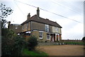
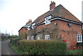
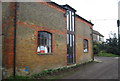
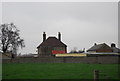
Lower Goldstone, butchers shop and farm entrance.
Image: © Nick Smith
Taken: 9 Jan 2007
0.01 miles
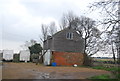
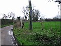
4
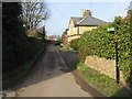
Road from Lower Goldstone
The footpath leads to Upper Goldstone
Image: © Nick Smith
Taken: 31 Jan 2009
0.02 miles
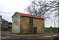
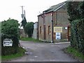
10
Lane just past the butchers shop, Lower Goldstone.
Image: © Nick Smith
Taken: 9 Jan 2007
0.03 miles