IMAGES TAKEN NEAR TO
Garrington, CANTERBURY, CT3 1XG
Introduction
This page details the photographs taken nearby to Garrington, CT3 1XG by members of the Geograph project.
The Geograph project started in 2005 with the aim of publishing, organising and preserving representative images for every square kilometre of Great Britain, Ireland and the Isle of Man.

There are currently over 7.5m images from over14,400 individuals and you can help contribute to the project by visiting https://www.geograph.org.uk
Image Map
Images are licensed for reuse under creativecommons.org/licenses/by-sa/2.0
Notes
- Clicking on the map will re-center to the selected point.
- The higher the marker number, the further away the image location is from the centre of the postcode.
Image Listing (26 Images Found)
Images are licensed for reuse under creativecommons.org/licenses/by-sa/2.0
Image
Details
Distance


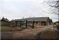
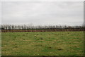
5
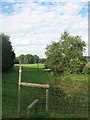
Stile near Linces Wood
This wood is on a footpath from Lower Garrington Farm leading towards Bekesbourne. Linces Wood is on the left.
Image: © David Anstiss
Taken: 5 Sep 2010
0.07 miles
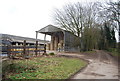
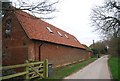
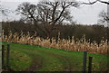
7
A herd of black cattle beside the Nail Bourne
A footpath runs between the river and the electricity pole at this point.
Image: © John Baker
Taken: 19 Apr 2015
0.10 miles