IMAGES TAKEN NEAR TO
Lee Priory, CANTERBURY, CT3 1UR
Introduction
This page details the photographs taken nearby to Lee Priory, CT3 1UR by members of the Geograph project.
The Geograph project started in 2005 with the aim of publishing, organising and preserving representative images for every square kilometre of Great Britain, Ireland and the Isle of Man.

There are currently over 7.5m images from over14,400 individuals and you can help contribute to the project by visiting https://www.geograph.org.uk
Image Map
Images are licensed for reuse under creativecommons.org/licenses/by-sa/2.0
Notes
- Clicking on the map will re-center to the selected point.
- The higher the marker number, the further away the image location is from the centre of the postcode.
Image Listing (19 Images Found)
Images are licensed for reuse under creativecommons.org/licenses/by-sa/2.0
Image
Details
Distance
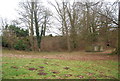
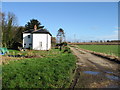
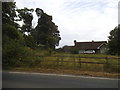
2
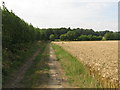
Lee Priory Farm track
A footpath from Bramling Road, leads towards the farm, then it should lead right through the field on the right and through the hedge beside an orchard.
Image: © David Anstiss
Taken: 15 Aug 2010
0.17 miles
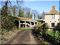
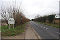
3
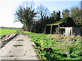
End of the metalled road at Lee Priory Farm.
Image: © Nick Smith
Taken: 21 Jan 2007
0.17 miles
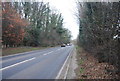
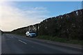
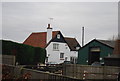
8
Bungalow on Wingham Road, Littlebourne
Image: © David Howard
Taken: 22 Jun 2017
0.20 miles