IMAGES TAKEN NEAR TO
Littlebourne, CANTERBURY, CT3 1TL
Introduction
This page details the photographs taken nearby to CT3 1TL by members of the Geograph project.
The Geograph project started in 2005 with the aim of publishing, organising and preserving representative images for every square kilometre of Great Britain, Ireland and the Isle of Man.

There are currently over 7.5m images from over14,400 individuals and you can help contribute to the project by visiting https://www.geograph.org.uk
Image Map
Images are licensed for reuse under creativecommons.org/licenses/by-sa/2.0
Notes
- Clicking on the map will re-center to the selected point.
- The higher the marker number, the further away the image location is from the centre of the postcode.
Image Listing (26 Images Found)
Images are licensed for reuse under creativecommons.org/licenses/by-sa/2.0
Image
Details
Distance
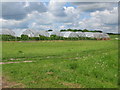
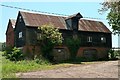
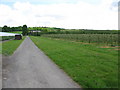
3
Private road and footpath to Woolton Farm
Image: © Nick Smith
Taken: 28 May 2010
0.07 miles
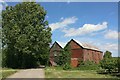
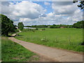
4
View over the orchards near Woolton Farm
Image: © Nick Smith
Taken: 28 May 2010
0.07 miles
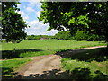
5
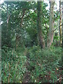
Footpath in Court Wood
A path leads from the A257 Canterbury Road through the wood and onwards towards Bekesbourne Lane.
Image: © David Anstiss
Taken: 15 Aug 2010
0.11 miles
6
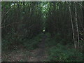
Footpath in Court Wood (2)
A path leads from Bekesbourne Lane through the wood towards the A257 Canterbury Road.
Image: © David Anstiss
Taken: 15 Aug 2010
0.11 miles
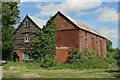
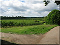
7
Looking NE along track and footpath from Woolton Farm
Image: © Nick Smith
Taken: 28 May 2010
0.13 miles