IMAGES TAKEN NEAR TO
Watercress Lane, CANTERBURY, CT3 1NR
Introduction
This page details the photographs taken nearby to Watercress Lane, CT3 1NR by members of the Geograph project.
The Geograph project started in 2005 with the aim of publishing, organising and preserving representative images for every square kilometre of Great Britain, Ireland and the Isle of Man.

There are currently over 7.5m images from over14,400 individuals and you can help contribute to the project by visiting https://www.geograph.org.uk
Image Map
Images are licensed for reuse under creativecommons.org/licenses/by-sa/2.0
Notes
- Clicking on the map will re-center to the selected point.
- The higher the marker number, the further away the image location is from the centre of the postcode.
Image Listing (26 Images Found)
Images are licensed for reuse under creativecommons.org/licenses/by-sa/2.0
Image
Details
Distance
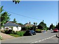
5
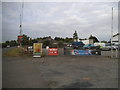
Garage yard on Canterbury Road, Wingham Green
Image: © David Howard
Taken: 22 Jun 2017
0.12 miles
6
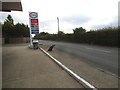
Petrol station on Canterbury Road, Wingham Green
This sold Harvest petrol in 2014
Image: © David Howard
Taken: 22 Jun 2017
0.13 miles
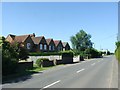
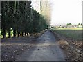
8
View due S to buildings alongside the A257
Image: © Nick Smith
Taken: 23 Sep 2010
0.13 miles
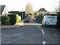
9
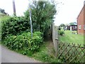
Footpath from Watercress Lane to Canterbury Road (A257)
Public footpath EE172.
Image: © Peter Holmes
Taken: 29 May 2016
0.14 miles
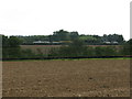
10
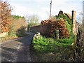
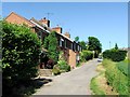
View along Watercress Lane, Wingham Well
Image: © Nick Smith
Taken: 7 Dec 2007
0.14 miles