IMAGES TAKEN NEAR TO
High Street, CANTERBURY, CT3 1AY
Introduction
This page details the photographs taken nearby to High Street, CT3 1AY by members of the Geograph project.
The Geograph project started in 2005 with the aim of publishing, organising and preserving representative images for every square kilometre of Great Britain, Ireland and the Isle of Man.

There are currently over 7.5m images from over14,400 individuals and you can help contribute to the project by visiting https://www.geograph.org.uk
Image Map
Images are licensed for reuse under creativecommons.org/licenses/by-sa/2.0
Notes
- Clicking on the map will re-center to the selected point.
- The higher the marker number, the further away the image location is from the centre of the postcode.
Image Listing (155 Images Found)
Images are licensed for reuse under creativecommons.org/licenses/by-sa/2.0
Image
Details
Distance
2
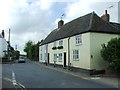
6, High Street
Situated almost opposite to the junction with Staple Road, a large sheet of wood had been placed over the nearest window on the first floor. It is possible that the window had been removed.
Image: © John Baker
Taken: 20 Aug 2014
0.02 miles
5
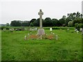
Wingham War Memorial
Situated in Wingham New Burial Ground, the Memorial honors those lost in the 1914-18 World War.
Image: © Peter Holmes
Taken: 30 May 2016
0.04 miles
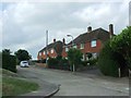
6
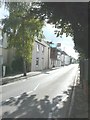
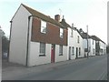
Row of cottages along the High Street,
The cottage, clad in scaffolding along its frontage, is featured in Image There was a notice on the front door asking for any mail to be left at the back, due to the scaffolding. One could see that work was being carried out to the back of the cottage, due to a pile of discarded roof battens lying on the ground.
Image: © John Baker
Taken: 6 Oct 2013
0.05 miles
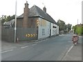
8
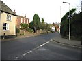
View N along the B2046 into Wingham from junction with Staple Road
Image: © Nick Smith
Taken: 25 Nov 2007
0.06 miles
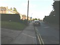
10
Row of cottages along the High Street, Wingham
There was a planning application fixed to the electricity pole - seen here as a small white rectangle - relating to number 20, the cottage with the half-tiled front, nearest to the camera. Subsequently, Planning permission was granted by Dover District Council under application number DOV/13/00025 for the "erection of a single storey and two storey rear extension and insertion of a rooflight (existing extension to be demolished)". It is doubtful if the new work will be visible from this location!
Image: © John Baker
Taken: 31 Jan 2013
0.06 miles