IMAGES TAKEN NEAR TO
Courtenay Road, CANTERBURY, CT2 9LD
Introduction
This page details the photographs taken nearby to Courtenay Road, CT2 9LD by members of the Geograph project.
The Geograph project started in 2005 with the aim of publishing, organising and preserving representative images for every square kilometre of Great Britain, Ireland and the Isle of Man.

There are currently over 7.5m images from over14,400 individuals and you can help contribute to the project by visiting https://www.geograph.org.uk
Image Map
Images are licensed for reuse under creativecommons.org/licenses/by-sa/2.0
Notes
- Clicking on the map will re-center to the selected point.
- The higher the marker number, the further away the image location is from the centre of the postcode.
Image Listing (9 Images Found)
Images are licensed for reuse under creativecommons.org/licenses/by-sa/2.0
Image
Details
Distance
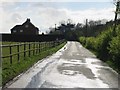
2
Dawes Road, Dunkirk
At the junction with Courtenay Road.
Image: © pam fray
Taken: 11 Jun 2018
0.15 miles
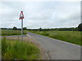
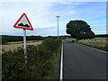
3
Dawes Road junction with Courtenay Road
Dawes Road goes to Boughton-under-Blean and Courtenay Road to Dunkirk, both on the old A2 London to Canterbury road.
Image: © Nick Smith
Taken: 8 Apr 2008
0.16 miles
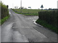
4
Courtenay Road
This looks down the road towards the junction with Dawes Road.
Image: © Marathon
Taken: 20 Sep 2022
0.19 miles
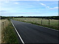
5
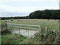
Cattle next to Dawes Road
This is near the junction with Courtenay Road. Blean Wood is behind.
Image: © Marathon
Taken: 20 Sep 2022
0.19 miles
6
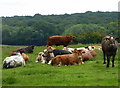
Cattle, Courtenay Road, Dunkirk
Bossingham Wood is in the distance.
Image: © pam fray
Taken: 11 Jun 2018
0.21 miles
7

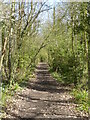
Bridleway in Blean Wood (1)
This bridleway leads from Holly Hill Farm towards Butler's Hill, Dargate.
Image: © David Anstiss
Taken: 25 Oct 2009
0.24 miles
8
Courtenay Road
This looks down the road towards the junction with Dawes Road.
Image: © Marathon
Taken: 20 Sep 2022
0.24 miles
9
Track through Blean Wood, Dargate
The track is known as Red Road and it runs between Butler's Hill and Dawes Road.
Image: © pam fray
Taken: 25 Mar 2021
0.25 miles