IMAGES TAKEN NEAR TO
Courtenay Road, CANTERBURY, CT2 9LB
Introduction
This page details the photographs taken nearby to Courtenay Road, CT2 9LB by members of the Geograph project.
The Geograph project started in 2005 with the aim of publishing, organising and preserving representative images for every square kilometre of Great Britain, Ireland and the Isle of Man.

There are currently over 7.5m images from over14,400 individuals and you can help contribute to the project by visiting https://www.geograph.org.uk
Image Map
Images are licensed for reuse under creativecommons.org/licenses/by-sa/2.0
Notes
- Clicking on the map will re-center to the selected point.
- The higher the marker number, the further away the image location is from the centre of the postcode.
Image Listing (12 Images Found)
Images are licensed for reuse under creativecommons.org/licenses/by-sa/2.0
Image
Details
Distance
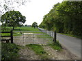
1
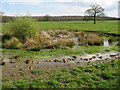
Small pond in field next to Courtenay Road
There were two of these boggy areas in an essentially level field on the highest part of the surrounding area, possibly man made but this one looks almost as though the land has subsided a bit allowing it to hold rainwater.
Image: © Nick Smith
Taken: 8 Apr 2008
0.07 miles
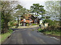
4
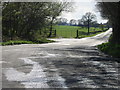
Courtenay Road from the junction with Dargate Road
Image: © Nick Smith
Taken: 8 Apr 2008
0.12 miles
5
Courtenay Road
The view south-west towards Dunkirk.
Image: © Jonathan Billinger
Taken: 25 Apr 2007
0.17 miles
6
Bradbourne cottages on the junction of Courtenay Road and Denstroude Lane
Image: © Nick Smith
Taken: 8 Apr 2008
0.21 miles
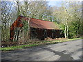
7
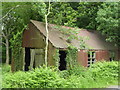
Disused shack, Courtenay Road
A corrugated iron ruined building near the junction with Dargate Road.
Image: © pam fray
Taken: 11 Jun 2018
0.22 miles
9
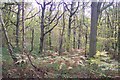
Blean woods
As seen from a bridleway leading from Holly Hill Farm towards Butler's Hill, Dargate.
Image: © David Anstiss
Taken: 26 Oct 2009
0.22 miles
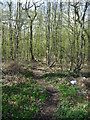
10
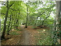
Path from North Bishopden Wood
North Bishopden Wood is part of Blean Woods National Nature Reserve and the woodland path here leads to Courtenay Road and Blean Wood on the other side.
Image: © Marathon
Taken: 20 Sep 2022
0.23 miles