IMAGES TAKEN NEAR TO
Moat Lane, CANTERBURY, CT2 9DR
Introduction
This page details the photographs taken nearby to Moat Lane, CT2 9DR by members of the Geograph project.
The Geograph project started in 2005 with the aim of publishing, organising and preserving representative images for every square kilometre of Great Britain, Ireland and the Isle of Man.

There are currently over 7.5m images from over14,400 individuals and you can help contribute to the project by visiting https://www.geograph.org.uk
Image Map
Images are licensed for reuse under creativecommons.org/licenses/by-sa/2.0
Notes
- Clicking on the map will re-center to the selected point.
- The higher the marker number, the further away the image location is from the centre of the postcode.
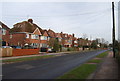
Image Listing (38 Images Found)
Images are licensed for reuse under creativecommons.org/licenses/by-sa/2.0
Image
Details
Distance
1
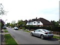
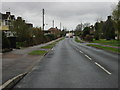
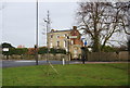
Morning rush-hour on the A290 Whitstable road
Image: © David Long
Taken: 21 Apr 2006
0.09 miles
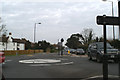
6
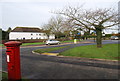
Post Box close to the junction of Rough Common Rd & A290
Image: © N Chadwick
Taken: 24 Jan 2009
0.11 miles
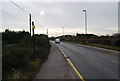
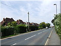
8
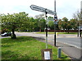
Road sign at the junction of Rough Rd & A290
Image: © N Chadwick
Taken: 24 Jan 2009
0.13 miles