IMAGES TAKEN NEAR TO
Oaks View, HYTHE, CT21 6NS
Introduction
This page details the photographs taken nearby to Oaks View, CT21 6NS by members of the Geograph project.
The Geograph project started in 2005 with the aim of publishing, organising and preserving representative images for every square kilometre of Great Britain, Ireland and the Isle of Man.

There are currently over 7.5m images from over14,400 individuals and you can help contribute to the project by visiting https://www.geograph.org.uk
Image Map
Images are licensed for reuse under creativecommons.org/licenses/by-sa/2.0
Notes
- Clicking on the map will re-center to the selected point.
- The higher the marker number, the further away the image location is from the centre of the postcode.
Image Listing (74 Images Found)
Images are licensed for reuse under creativecommons.org/licenses/by-sa/2.0
Image
Details
Distance
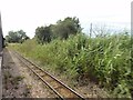
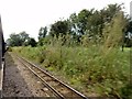
3
Hythe/Kent - 2008
Romney, Hythe & Dymchurch Railway, Nickolls Quarries Lake, Sailing Club.
Image: © Helmut Zozmann
Taken: 5 Jul 2008
0.12 miles
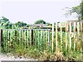
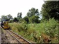
4
Palmarsh, RH&DR
Palmarsh, RH&DR, footpath level crossing between Heron's Way and Palmbeach Avenue.
Image: © Helmut Zozmann
Taken: 5 Aug 2012
0.12 miles
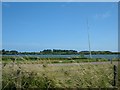
8
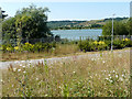
Looking northwest from Castle View
Castle View is part of the Martello Lakes Housing Development.
Planning permission was approved, with conditions, by Folkestone and Hythe District Council under application number Y06/1079/SH for the “outline application for mixed use development comprising residential development (1050 dwellings); employment development (use class B1, 15,000 sq.m); local centre (500 sq.m use classes A1/A2, 500 sq.m use classes A3/A4/A5); community centre /community facilities (1,000 sq.m use class D1); public open space (8.5 HA); structural open space (10.3 HA); retention and alteration of water bodies (retained area 15.5 HA); provision of two new access points to Dymchurch Road; and site restoration including raising of land levels”. The location was given as Nickolls Quarry, Dymchurch Road, Hythe, Kent, CT21 4NE.
I assume the building referred to in the road name is Lympne Castle but it is hidden from view here.
Image: © John Baker
Taken: 8 Jul 2018
0.13 miles
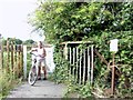
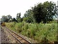
9

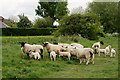
Sheep Near Hythe
Seen in a field beside the Romney, Hythe and Dymchurch Railway.
Image: © Peter Trimming
Taken: 11 May 2019
0.14 miles
10
Sheep Near Hythe
Seen in a field beside the Romney, Hythe and Dymchurch Railway.
Image: © Peter Trimming
Taken: 11 May 2019
0.14 miles