IMAGES TAKEN NEAR TO
Studfall Close, HYTHE, CT21 6NN
Introduction
This page details the photographs taken nearby to Studfall Close, CT21 6NN by members of the Geograph project.
The Geograph project started in 2005 with the aim of publishing, organising and preserving representative images for every square kilometre of Great Britain, Ireland and the Isle of Man.

There are currently over 7.5m images from over14,400 individuals and you can help contribute to the project by visiting https://www.geograph.org.uk
Image Map
Images are licensed for reuse under creativecommons.org/licenses/by-sa/2.0
Notes
- Clicking on the map will re-center to the selected point.
- The higher the marker number, the further away the image location is from the centre of the postcode.
Image Listing (42 Images Found)
Images are licensed for reuse under creativecommons.org/licenses/by-sa/2.0
Image
Details
Distance
1
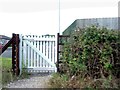
Palmarsh, RH&DR
Palmarsh, RH&DR, footpath level crossing between Heron's Way and Palmbeach Avenue.
Image: © Helmut Zozmann
Taken: 5 Aug 2012
0.09 miles
3
Hythe/Kent - 2008
Hythe, Palmarsh, Romney, Hythe & Dymchurch Railway.
Image: © Helmut Zozmann
Taken: 5 Jul 2008
0.11 miles
5
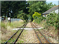
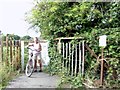
RH&DR foot crossing, Palmarsh
This appears to give access from housing north of the line to Palmarsh Primary School. Is there a school crossing lady here?
Image: © Robin Webster
Taken: 13 Jul 2013
0.13 miles
6
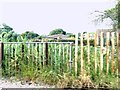
Palmarsh, RH&DR
Palmarsh, RH&DR, footpath level crossing between Nightingale Avenue and Palmarsh Primary School.
Image: © Helmut Zozmann
Taken: 5 Aug 2012
0.13 miles
7
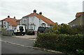
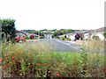
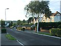
8, Palmarsh Avenue
Planning permission has been approved, with conditions, by Folkestone and Hythe District Council under application number 22/0595/FH for the “erection of a first floor extension”.
Number 8 had three vehicles parked in front of the house.
Image: © John Baker
Taken: 16 Oct 2022
0.14 miles
8
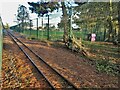
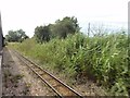
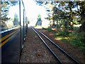
View from a Romney-Dungeness train - Passing Palmarsh School playing fields
The Romney Hythe and Dymchurch Railway is a 15 in (381 mm) gauge light railway opened in 1927.
Image: © Nigel Thompson
Taken: 25 Oct 2017
0.14 miles