IMAGES TAKEN NEAR TO
Seabrook Road, HYTHE, CT21 5QR
Introduction
This page details the photographs taken nearby to Seabrook Road, CT21 5QR by members of the Geograph project.
The Geograph project started in 2005 with the aim of publishing, organising and preserving representative images for every square kilometre of Great Britain, Ireland and the Isle of Man.

There are currently over 7.5m images from over14,400 individuals and you can help contribute to the project by visiting https://www.geograph.org.uk
Image Map
Images are licensed for reuse under creativecommons.org/licenses/by-sa/2.0
Notes
- Clicking on the map will re-center to the selected point.
- The higher the marker number, the further away the image location is from the centre of the postcode.
Image Listing (83 Images Found)
Images are licensed for reuse under creativecommons.org/licenses/by-sa/2.0
Image
Details
Distance
1
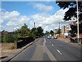
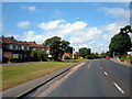
Hythe, Seabrook, Seabrook Road (A259)
Image: © Helmut Zozmann
Taken: 5 Jul 2008
0.03 miles
2
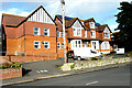
Cedar House, 93, Seabrook Road
Planning permission has been approved, with conditions, by Folkestone and Hythe District Council under application number 21/0715/FH for the “demolition of an existing single storey extension and conversion of an existing 27 bed residential care home and 1, 2 bed ancillary maisonette on the second floor, into 8 self-contained 2 bed flats”.
Image: © John Baker
Taken: 6 Feb 2022
0.03 miles
5
Hythe, Seabrook, Seabrook Road (A259)
Image: © Helmut Zozmann
Taken: 5 Jul 2008
0.10 miles
6

Royal Military Canal Path towards Seabrook Road
Image: © Ian S
Taken: 14 Dec 2019
0.10 miles
7
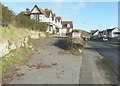
Cautley House, 93, Seabrook Road
In the past, it has been known as St Frederick’s Hotel and the Centre for Spiritual Healing and according to the Folkestone and District Local History Society it was known as the Sea View Hotel in the early 20th century http://www.folkestonehistory.org/index.php?page=seabrook It has an air of neglect.
Image: © John Baker
Taken: 16 Dec 2014
0.10 miles
8

Cautley House, 95 Seabrook Road
Planning permission has been approved, with conditions, by Folkestone and Hythe District Council under application number Y18/1305/FH for the “erection of a residential development comprising of 14 residential units, associated undercroft parking, landscaping and ground works following demolition of the existing building”.
This was Image in December 2014.
Image: © John Baker
Taken: 9 Jan 2022
0.10 miles
9

Cautley House, 95 Seabrook Road
Viewed from Cliff Road, planning permission has been approved, with conditions, by Folkestone and Hythe District Council under application number Y18/1305/FH for the “erection of a residential development comprising of 14 residential units, associated undercroft parking, landscaping and ground works following demolition of the existing building”.
This view of Image was taken from Seabrook Road.
Image: © John Baker
Taken: 9 Jan 2022
0.10 miles
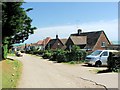
10

Footpath by the Royal Military Canal, Seabrook
Image: © pam fray
Taken: 3 Apr 2012
0.10 miles