1
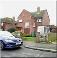
Brockhill Road, Hythe
Heading towards North Road.
In the background, is a roofscape over Hythe.
Image: © David Anstiss
Taken: 13 Nov 2010
0.07 miles
2
Quarry Road, Hythe
This close of houses, leads off Castle Road.
It is in a former quarry site.
Image: © David Anstiss
Taken: 13 Nov 2010
0.13 miles
3
Regency Court
Town houses (No's 40,40A and 42, 42A) on Bartholomew Street.
Image: © David Anstiss
Taken: 13 Nov 2010
0.16 miles
4
Hillside, Hythe
One of the narrow lanes on the hill above Hythe.
Image: © David Anstiss
Taken: 13 Nov 2010
0.17 miles
5
24, Seaton Avenue
Planning permission has been granted, with conditions, by Folkestone and Hythe District Council under application number 22/1684/FH for the "erection of front and rear extensions at ground and first floor and conversion of garage to living accommodation".
Taken during a photographic outing on New Year's Day afternoon.
Image: © John Baker
Taken: 1 Jan 2023
0.17 miles
6
View of houses on the hill from Hythe station on the Romney, Hythe & Dymchurch Railway
Looking north-northeast.
Image: © Robert Lamb
Taken: 4 Sep 2016
0.18 miles
7
View From Castle Road, Hythe, Kent
View from near the top of the hill, looking over the town and towards the sea in the direction of Dymchurch.
Image: © Peter Trimming
Taken: 17 Jun 2009
0.19 miles
8
Hythe - 2015
Hythe, Kent, Military Road, A259, Sainsbury's car park, Hythe Town Map
Image: © Helmut Zozmann
Taken: 11 Aug 2015
0.19 miles
9
Path at the Bottom of Castle Road, Hythe, Kent
Now blocked off to traffic, and used as a footpath. On this section of Castle Road, the gradient would have made life "interesting" for drivers.
Image: © Peter Trimming
Taken: 17 Jun 2009
0.19 miles
10
Construction of Sainsbury's Superstore, Hythe
A former offices on Military Road, has been demolished and a controversial new supermarket is being built.
Image: © David Anstiss
Taken: 13 Nov 2010
0.19 miles


