IMAGES TAKEN NEAR TO
Highfield Close, HYTHE, CT21 4QP
Introduction
This page details the photographs taken nearby to Highfield Close, CT21 4QP by members of the Geograph project.
The Geograph project started in 2005 with the aim of publishing, organising and preserving representative images for every square kilometre of Great Britain, Ireland and the Isle of Man.

There are currently over 7.5m images from over14,400 individuals and you can help contribute to the project by visiting https://www.geograph.org.uk
Image Map
Images are licensed for reuse under creativecommons.org/licenses/by-sa/2.0
Notes
- Clicking on the map will re-center to the selected point.
- The higher the marker number, the further away the image location is from the centre of the postcode.
Image Listing (29 Images Found)
Images are licensed for reuse under creativecommons.org/licenses/by-sa/2.0
Image
Details
Distance
1
Creation of an annex at Sandtiles, Sandling Road
Planning permission has been approved, with conditions, by Folkestone and Hythe District Council under application number Y13/0734/SH for “alterations to existing garage to create a two storey annex building”.
Image: © John Baker
Taken: 2 Mar 2014
0.07 miles
2
Forge House, Grange Road
Scaffolding has been erected to chimney height at this end of the building.
Image: © John Baker
Taken: 2 Mar 2014
0.12 miles
5

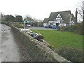
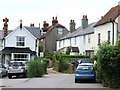
Saltwood - 2015
Saltwood, Kent, The Green
Image: © Helmut Zozmann
Taken: 8 Aug 2015
0.13 miles
7
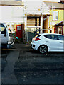
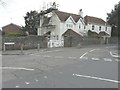
St John Ambulance Headquarters, New Road
Planning permission has been approved, with conditions, by Folkestone and Hythe District Council under application number 21/0175/FH for the “conversion of a derelict commercial property into a residential family home”.
Image: © John Baker
Taken: 28 Nov 2021
0.14 miles
8
Castle Hotel, Saltwood, Kent
A large pub standing opposite the village green.
Image: © Peter Trimming
Taken: 17 Jun 2009
0.15 miles
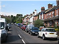
9
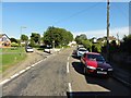
Saltwood - 2015
Saltwood, Kent, The Green
Image: © Helmut Zozmann
Taken: 8 Aug 2015
0.15 miles
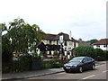
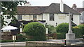
10
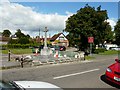
Saltwood war memorial under repair
The subject of the cleaning and repair of the war memorial was brought up at meetings of the Parish Council on 05/09/10 and 04/10/10. The half-timbered building behind the memorial is the village hall. The day after I took the photo, the memorial was featured on the BBC's South East Today TV programme and this link provides full information about the restoration work that has been carried out http://www.saltwoodkent.co.uk/
Image: © John Baker
Taken: 14 Aug 2011
0.15 miles