IMAGES TAKEN NEAR TO
Lympne, HYTHE, CT21 4LX
Introduction
This page details the photographs taken nearby to CT21 4LX by members of the Geograph project.
The Geograph project started in 2005 with the aim of publishing, organising and preserving representative images for every square kilometre of Great Britain, Ireland and the Isle of Man.

There are currently over 7.5m images from over14,400 individuals and you can help contribute to the project by visiting https://www.geograph.org.uk
Image Map
Images are licensed for reuse under creativecommons.org/licenses/by-sa/2.0
Notes
- Clicking on the map will re-center to the selected point.
- The higher the marker number, the further away the image location is from the centre of the postcode.
Image Listing (44 Images Found)
Images are licensed for reuse under creativecommons.org/licenses/by-sa/2.0
Image
Details
Distance
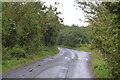
1
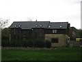
Oathill Farm Barn
On Aldington Road, near Oathill Cottages.
Image: © David Anstiss
Taken: 17 Oct 2010
0.01 miles
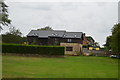
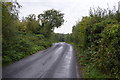
4
Oathill Barn, Aldington Road, Lympne
Image: © Oast House Archive
Taken: 14 Mar 2015
0.01 miles
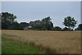
7
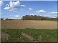
Fields east of Lympne
With a view towards Folks' Wood.
Image: © Stephen Craven
Taken: 11 Apr 2015
0.09 miles
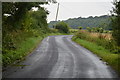

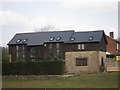
10
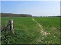
Saxon Shore Way heading towards Folks' Wood
The long distance footpath leaving the Roman Road east of Lympne to head across a large field towards Folks' Wood.
Image: © Chris Heaton
Taken: 1 May 2013
0.09 miles