IMAGES TAKEN NEAR TO
Ashford Road, HYTHE, CT21 4JD
Introduction
This page details the photographs taken nearby to Ashford Road, CT21 4JD by members of the Geograph project.
The Geograph project started in 2005 with the aim of publishing, organising and preserving representative images for every square kilometre of Great Britain, Ireland and the Isle of Man.

There are currently over 7.5m images from over14,400 individuals and you can help contribute to the project by visiting https://www.geograph.org.uk
Image Map
Images are licensed for reuse under creativecommons.org/licenses/by-sa/2.0
Notes
- Clicking on the map will re-center to the selected point.
- The higher the marker number, the further away the image location is from the centre of the postcode.
Image Listing (14 Images Found)
Images are licensed for reuse under creativecommons.org/licenses/by-sa/2.0
Image
Details
Distance
1
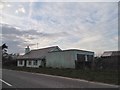
Rose Cottage on Ashford Road, Newingreen
It's not often a single modern house has its own OS map entry although it does include the farm buildings as well.
Image: © David Howard
Taken: 10 Apr 2016
0.08 miles
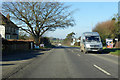
4
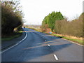
A20 Ashford Road
The white-painted building in the distance is Rose Cottage. The leaning signpost points to a footpath along a paved track that takes you to Folkestone Racecourse and Westenhanger Castle.
Image: © John Baker
Taken: 28 Apr 2013
0.09 miles
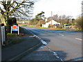
6
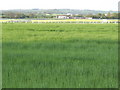
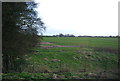
Corner of Folkestone Race Course
From north of the A20 by Rose Cottage.
Image: © Jonathan Billinger
Taken: 25 Apr 2007
0.09 miles
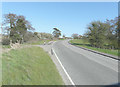
7
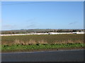
Folkestone racecourse from the A20 Ashford Road
Image: © Nick Smith
Taken: 17 Jan 2010
0.09 miles
8
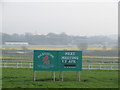
Folkestone Racecourse
Established in 1898, this is the only racecourse in Kent. The board can be seen from the A20 between the village of Sellindge and the J11 of the M20. The grandstand can be seen in the background.
Image: © Adam Hincks
Taken: 14 Apr 2007
0.14 miles
10
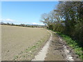
Paved track to Westenhanger pumping station
David Anstiss' view Image shows the trees in leaf.
Image: © John Baker
Taken: 28 Apr 2013
0.18 miles