IMAGES TAKEN NEAR TO
Island Road, CANTERBURY, CT2 0EF
Introduction
This page details the photographs taken nearby to Island Road, CT2 0EF by members of the Geograph project.
The Geograph project started in 2005 with the aim of publishing, organising and preserving representative images for every square kilometre of Great Britain, Ireland and the Isle of Man.

There are currently over 7.5m images from over14,400 individuals and you can help contribute to the project by visiting https://www.geograph.org.uk
Image Map
Images are licensed for reuse under creativecommons.org/licenses/by-sa/2.0
Notes
- Clicking on the map will re-center to the selected point.
- The higher the marker number, the further away the image location is from the centre of the postcode.
Image Listing (30 Images Found)
Images are licensed for reuse under creativecommons.org/licenses/by-sa/2.0
Image
Details
Distance
1
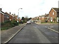
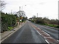
The A28 in Sturry
This is at the junction with Fairview Gardens.
Image: © Marathon
Taken: 7 Jul 2016
0.03 miles
3
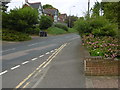
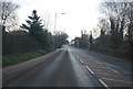
Fairview Gardens, Sturry
This is at the eastern end of Sturry.
Image: © Marathon
Taken: 7 Jul 2016
0.08 miles
7
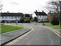
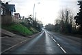
Junction of Homewood Road and Island Road, Sturry
Image: © Nick Smith
Taken: 18 Mar 2007
0.13 miles
8
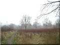
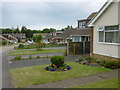
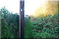
Westbere, new woodland
Looking towards Island Road, Westbere. Part of a series of images recording the land before proposed redevelopment in the Sturry area.
Image: © Chris Boucher
Taken: 2 Mar 2021
0.14 miles
9
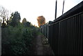
Between the houses and the railway
On the left is the Ashford to Ramsgate line, on the right houses in Sturry.
Image: © N Chadwick
Taken: 19 Nov 2011
0.14 miles