IMAGES TAKEN NEAR TO
King Street, CANTERBURY, CT2 0BY
Introduction
This page details the photographs taken nearby to King Street, CT2 0BY by members of the Geograph project.
The Geograph project started in 2005 with the aim of publishing, organising and preserving representative images for every square kilometre of Great Britain, Ireland and the Isle of Man.

There are currently over 7.5m images from over14,400 individuals and you can help contribute to the project by visiting https://www.geograph.org.uk
Image Map
Images are licensed for reuse under creativecommons.org/licenses/by-sa/2.0
Notes
- Clicking on the map will re-center to the selected point.
- The higher the marker number, the further away the image location is from the centre of the postcode.
Image Listing (265 Images Found)
Images are licensed for reuse under creativecommons.org/licenses/by-sa/2.0
Image
Details
Distance
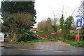
3
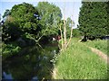
View Eastwards along the Stour to Fordwich
The cycle track from Fordwich to Canterbury is to the left of the picture, initially this is the route of the Stour Valley Walk
Image: © Nick Smith
Taken: 2 Jun 2007
0.02 miles
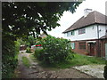
5
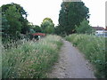
Cycleway, Fordwich
National cycle route no. 1 alongside the river Great Stour near Fordwich bridge.
Image: © E Gammie
Taken: 8 Jul 2010
0.02 miles
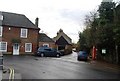
7
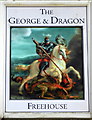
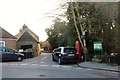
The George and Dragon pub sign, Fordwich
In the car park opposite the pub in King Street.
Image: © pam fray
Taken: 20 May 2018
0.03 miles