IMAGES TAKEN NEAR TO
Hollands Avenue, FOLKESTONE, CT19 6PN
Introduction
This page details the photographs taken nearby to Hollands Avenue, CT19 6PN by members of the Geograph project.
The Geograph project started in 2005 with the aim of publishing, organising and preserving representative images for every square kilometre of Great Britain, Ireland and the Isle of Man.

There are currently over 7.5m images from over14,400 individuals and you can help contribute to the project by visiting https://www.geograph.org.uk
Image Map
Images are licensed for reuse under creativecommons.org/licenses/by-sa/2.0
Notes
- Clicking on the map will re-center to the selected point.
- The higher the marker number, the further away the image location is from the centre of the postcode.
Image Listing (206 Images Found)
Images are licensed for reuse under creativecommons.org/licenses/by-sa/2.0
Image
Details
Distance
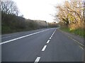
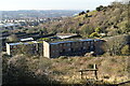
1

Folkestone - 2014
Folkestone, Kent, Foord, Public Footpath No. HF 1
Image: © Robert Zozmann
Taken: 29 Sep 2014
0.07 miles
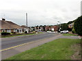
3
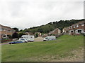
Folkestone, Hollands Avenue
Folkestone, Hollands Avenue seen from Swiss Way.
Image: © Helmut Zozmann
Taken: 29 Jul 2011
0.07 miles
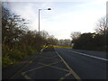
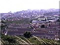
4

Folkestone - 2014
Folkestone, Kent, Foord, Public Footpath No. HF 1
Image: © Robert Zozmann
Taken: 29 Sep 2014
0.07 miles
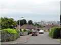
5

Folkestone - 2014
Folkestone, Kent, Foord, Public Footpath No. HF 1
Image: © Helmut Zozmann
Taken: 29 Sep 2014
0.08 miles
6
Folkestone - 1999
Folkestone, Kent, Public Footpath No. HF1, 'North Downs Way', 'Saxon Shore Way'
Image: © Helmut Zozmann
Taken: 16 Jul 1999
0.09 miles