IMAGES TAKEN NEAR TO
Lynwood, FOLKESTONE, CT19 5TA
Introduction
This page details the photographs taken nearby to Lynwood, CT19 5TA by members of the Geograph project.
The Geograph project started in 2005 with the aim of publishing, organising and preserving representative images for every square kilometre of Great Britain, Ireland and the Isle of Man.

There are currently over 7.5m images from over14,400 individuals and you can help contribute to the project by visiting https://www.geograph.org.uk
Image Map
Images are licensed for reuse under creativecommons.org/licenses/by-sa/2.0
Notes
- Clicking on the map will re-center to the selected point.
- The higher the marker number, the further away the image location is from the centre of the postcode.
Image Listing (62 Images Found)
Images are licensed for reuse under creativecommons.org/licenses/by-sa/2.0
Image
Details
Distance
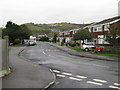
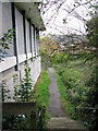
1
View along Beech Close towards Sugarloaf Hill
Image: © Nick Smith
Taken: 14 Oct 2009
0.03 miles
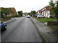
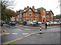
4
Looking E along Alder Road from Beech Close
Image: © Nick Smith
Taken: 14 Oct 2009
0.10 miles
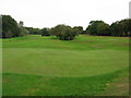
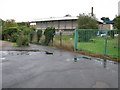
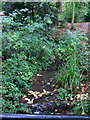
8
Footpath along the side of Folkestone sports centre
Image: © Nick Smith
Taken: 14 Oct 2009
0.12 miles
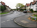
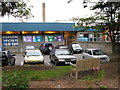
10
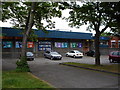
Folkestone Sports Centre
Looking north east to Folkestone Sports Centre from Radnor Park Avenue.
Image: © D-G-Seamon
Taken: 10 May 2007
0.13 miles