IMAGES TAKEN NEAR TO
Avereng Road, FOLKESTONE, CT19 5HT
Introduction
This page details the photographs taken nearby to Avereng Road, CT19 5HT by members of the Geograph project.
The Geograph project started in 2005 with the aim of publishing, organising and preserving representative images for every square kilometre of Great Britain, Ireland and the Isle of Man.

There are currently over 7.5m images from over14,400 individuals and you can help contribute to the project by visiting https://www.geograph.org.uk
Image Map
Images are licensed for reuse under creativecommons.org/licenses/by-sa/2.0
Notes
- Clicking on the map will re-center to the selected point.
- The higher the marker number, the further away the image location is from the centre of the postcode.
Image Listing (97 Images Found)
Images are licensed for reuse under creativecommons.org/licenses/by-sa/2.0
Image
Details
Distance
1
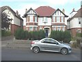
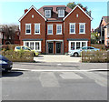
31, Julian Road
In January 2014, Image had its frontage covered with scaffolding. In the intervening period, I observed that its roof tiles were removed and replaced with brand-new tiles to leave the house looking pristine.
Image: © John Baker
Taken: 25 Sep 2014
0.05 miles
2
31 Julian Road
This is the house that has had scaffolding erected on its frontage to roof level. This is Image after the scaffolding had been removed, following the replacement of its roof tiles with new ones.
Image: © John Baker
Taken: 23 Jan 2014
0.05 miles
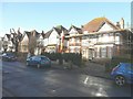
3
17 Julian Road
This large house, which also stands on the corner of Wilton Road, has been divided into flats and this view shows that scaffolding has been erected to roof level.
Image: © John Baker
Taken: 23 Jan 2014
0.06 miles
4
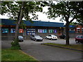
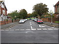
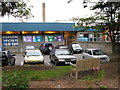
Folkestone Sports Centre
Looking north east to Folkestone Sports Centre from Radnor Park Avenue.
Image: © D-G-Seamon
Taken: 10 May 2007
0.07 miles
6
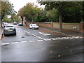
Wilton Road off Julian Road
Looking towards Radnor Park
Image: © Nick Smith
Taken: 14 Oct 2009
0.08 miles
8
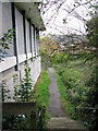
Footpath along the side of Folkestone sports centre
Image: © Nick Smith
Taken: 14 Oct 2009
0.08 miles
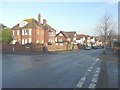
9
Semi-detached house, Radnor Park Avenue
The house on the left has been named Belmont and that on the right Claremount. The house was built in the garden of Image
Image: © John Baker
Taken: 18 Aug 2020
0.09 miles
10
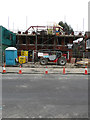
34, Julian Road
Seen from Radnor Park Avenue, planning permission has been approved, with conditions, by Folkestone and Hythe District Council under application number
Y18/0355/SH for the “erection of a pair of semi-detached houses with associated access and landscaping (resubmission of Y17/0927/SH)”.
It would appear that the houses are being built in the garden of the house in Julian Road.
Image: © John Baker
Taken: 27 Mar 2019
0.09 miles