IMAGES TAKEN NEAR TO
Bournemouth Road, FOLKESTONE, CT19 5AZ
Introduction
This page details the photographs taken nearby to Bournemouth Road, CT19 5AZ by members of the Geograph project.
The Geograph project started in 2005 with the aim of publishing, organising and preserving representative images for every square kilometre of Great Britain, Ireland and the Isle of Man.

There are currently over 7.5m images from over14,400 individuals and you can help contribute to the project by visiting https://www.geograph.org.uk
Image Map
Images are licensed for reuse under creativecommons.org/licenses/by-sa/2.0
Notes
- Clicking on the map will re-center to the selected point.
- The higher the marker number, the further away the image location is from the centre of the postcode.
Image Listing (221 Images Found)
Images are licensed for reuse under creativecommons.org/licenses/by-sa/2.0
Image
Details
Distance
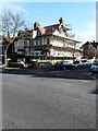
7
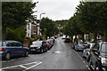
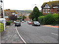
Bournemouth Road, Folkestone
The painted sign "try our bread, homemade cakes" on the side of the nearest house indicates that it was once a shop.
Image: © John Baker
Taken: 9 Mar 2012
0.07 miles
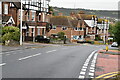
8
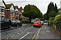
St John's Church, Folkestone
On St.John's Church Road.
Image: © David Anstiss
Taken: 31 Jan 2009
0.07 miles
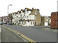
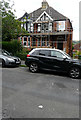
9
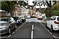
44, Radnor Park Road
The frontage and side of this address are covered with scaffolding. It appears that new roof tiles have been laid.
Image: © John Baker
Taken: 11 Feb 2016
0.07 miles
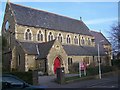
10
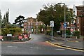
6-8, St John?s Church Road
Number 6 is the semi-detached house on whose frontage scaffolding has been erected.
Image: © John Baker
Taken: 22 Jul 2018
0.08 miles