IMAGES TAKEN NEAR TO
Church Road, FOLKESTONE, CT18 8HZ
Introduction
This page details the photographs taken nearby to Church Road, CT18 8HZ by members of the Geograph project.
The Geograph project started in 2005 with the aim of publishing, organising and preserving representative images for every square kilometre of Great Britain, Ireland and the Isle of Man.

There are currently over 7.5m images from over14,400 individuals and you can help contribute to the project by visiting https://www.geograph.org.uk
Image Map
Images are licensed for reuse under creativecommons.org/licenses/by-sa/2.0
Notes
- Clicking on the map will re-center to the selected point.
- The higher the marker number, the further away the image location is from the centre of the postcode.
Image Listing (128 Images Found)
Images are licensed for reuse under creativecommons.org/licenses/by-sa/2.0
Image
Details
Distance

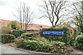
2
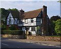
Old Robus, Lyminge
Grade II Listed Building - see https://historicengland.org.uk/listing/the-list/list-entry/1242113
Image: © Ian Taylor
Taken: 7 Sep 2017
0.07 miles
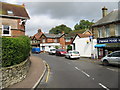
7
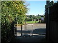
Footpath crosses Church Road
A path leads from Palm Tree Way, across the road towards Tayne Field (Recreation Ground).
Image: © David Anstiss
Taken: 10 Oct 2010
0.08 miles