IMAGES TAKEN NEAR TO
Stempe Close, FOLKESTONE, CT18 7PQ
Introduction
This page details the photographs taken nearby to Stempe Close, CT18 7PQ by members of the Geograph project.
The Geograph project started in 2005 with the aim of publishing, organising and preserving representative images for every square kilometre of Great Britain, Ireland and the Isle of Man.

There are currently over 7.5m images from over14,400 individuals and you can help contribute to the project by visiting https://www.geograph.org.uk
Image Map
Images are licensed for reuse under creativecommons.org/licenses/by-sa/2.0
Notes
- Clicking on the map will re-center to the selected point.
- The higher the marker number, the further away the image location is from the centre of the postcode.
Image Listing (87 Images Found)
Images are licensed for reuse under creativecommons.org/licenses/by-sa/2.0
Image
Details
Distance
1
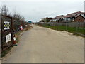
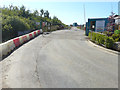
Road to builder?s storage area
This was the Image in October 2020. It is on an estate called Terlingham Forum.
Image: © John Baker
Taken: 3 Apr 2021
0.09 miles
2
Road to builder?s storage area
This was the Image in August 2018. It is on an estate called Terlingham Forum.
Image: © John Baker
Taken: 27 Mar 2019
0.09 miles
3
Road to builder?s storage area
This was the Image in March 2019. It is on an estate called Terlingham Forum.
Image: © John Baker
Taken: 10 Oct 2019
0.09 miles
4
Road to builder?s storage area
This was the Image in October 2019. It is on an estate called Terlingham Forum.
Image: © John Baker
Taken: 13 Oct 2020
0.09 miles
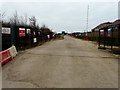
5
Road to builder?s storage area
On an estate called Terlingham Forum.
Image: © John Baker
Taken: 17 Aug 2018
0.10 miles
6
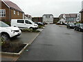
Juniper Way
One of the roads on an estate called Terlingham Forum.
Image: © John Baker
Taken: 13 Oct 2020
0.12 miles
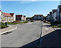
7
Juniper Way
This was Image in October 2020. It is a road on an estate called Terlingham Forum.
Image: © John Baker
Taken: 3 Apr 2021
0.13 miles
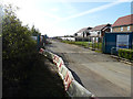
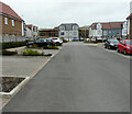
8
Juniper Way
This view of Image is looking in the other direction. It is a road on an estate called Terlingham Forum.
Image: © John Baker
Taken: 17 Aug 2018
0.13 miles
9
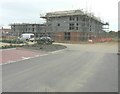
Progress of the development of land adjoining The Mayfly, Defiant Close
When last photographed on 18 September 2014, the Image showed the work on the building had reached the second storey. Here, the roof joists are in position and the design looks as if it will be similar to Image Planning permission has been approved, with conditions, by Folkestone and Hythe District Council under application number Y10/0739/SH for a “mixed used development comprising the erection of 4, three storey blocks providing 8 ground floor commercial units (Classes A1, A2, A3, B1 uses) and 48, two bedroom apartments above, together with associated access, parking, landscaping and open space”. The Mayfly refers to Image
Image: © John Baker
Taken: 23 Oct 2014
0.13 miles
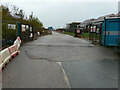
10

Progress of the development of land adjoining The Mayfly, Defiant Close
Last photographed on 27 May 2014, the Image was taken from the end of the road seen in the distance. Planning permission has been approved, with conditions, by Folkestone and Hythe District Council under application number Y10/0739/SH for a “mixed used development comprising the erection of 4, three storey blocks providing 8 ground floor commercial units (Classes A1, A2, A3, B1 uses) and 48, two bedroom apartments above, together with associated access, parking, landscaping and open space”. The Mayfly refers to Image
Image: © John Baker
Taken: 18 Sep 2014
0.14 miles