IMAGES TAKEN NEAR TO
Clarence Road, FOLKESTONE, CT18 7LW
Introduction
This page details the photographs taken nearby to Clarence Road, CT18 7LW by members of the Geograph project.
The Geograph project started in 2005 with the aim of publishing, organising and preserving representative images for every square kilometre of Great Britain, Ireland and the Isle of Man.

There are currently over 7.5m images from over14,400 individuals and you can help contribute to the project by visiting https://www.geograph.org.uk
Image Map
Images are licensed for reuse under creativecommons.org/licenses/by-sa/2.0
Notes
- Clicking on the map will re-center to the selected point.
- The higher the marker number, the further away the image location is from the centre of the postcode.
Image Listing (58 Images Found)
Images are licensed for reuse under creativecommons.org/licenses/by-sa/2.0
Image
Details
Distance
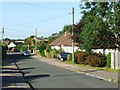
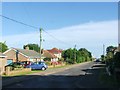
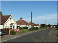
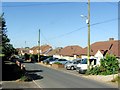
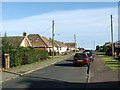
4
Victoria Road, Capel-le-Ferne
Capel-le-Ferne is a cliff top rather than a seaside village but, like many south coast places, it has a significant number of bungalows. Many of them are no doubt occupied by retired people.
Image: © Stephen McKay
Taken: 16 Jun 2023
0.07 miles
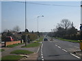
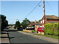
7
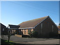
St. Radigund Church, Capel-le-Ferne
On Albany Road, opposite Albert Road.
Image: © David Anstiss
Taken: 27 Feb 2011
0.10 miles