IMAGES TAKEN NEAR TO
New Dover Road, FOLKESTONE, CT18 7JD
Introduction
This page details the photographs taken nearby to New Dover Road, CT18 7JD by members of the Geograph project.
The Geograph project started in 2005 with the aim of publishing, organising and preserving representative images for every square kilometre of Great Britain, Ireland and the Isle of Man.

There are currently over 7.5m images from over14,400 individuals and you can help contribute to the project by visiting https://www.geograph.org.uk
Image Map
Images are licensed for reuse under creativecommons.org/licenses/by-sa/2.0
Notes
- Clicking on the map will re-center to the selected point.
- The higher the marker number, the further away the image location is from the centre of the postcode.
Image Listing (57 Images Found)
Images are licensed for reuse under creativecommons.org/licenses/by-sa/2.0
Image
Details
Distance
1
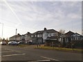
Houses on New Dover Road, Capel-le-Ferne
Image: © David Howard
Taken: 10 Apr 2016
0.02 miles
2

Electrical substation, Winehouse Lane, Capel-le-Ferne
Operated by UK Power Networks
Image: © Tim Heaton
Taken: 8 Aug 2019
0.07 miles
3
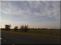
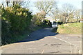
Fields by New Dover Road, Capel-le-Ferne
Image: © David Howard
Taken: 10 Apr 2016
0.09 miles
4
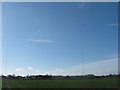
Masts on Whitehouse Lane
As seen from the footpath from Capel-le-Ferne towards the lane.
Image: © David Anstiss
Taken: 27 Feb 2011
0.10 miles
5
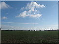
Masts near Capel-le-Ferne
The two masts on the right are on Whitehouse Lane. The one on the left is a Tv Transmitting Station near Great Hougham Farm.
Image: © David Anstiss
Taken: 27 Feb 2011
0.11 miles
6
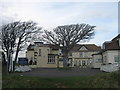
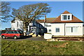
The Lighthouse Inn, Capel-le-Ferne
Bar, restaurant and guest house on Old Dover Road, near Winehouse Lane.
Image: © David Anstiss
Taken: 27 Feb 2011
0.13 miles
7
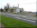
Grasslands, New Dover Road
Planning permission was granted by Dover District Council under application number DOV/17/00074 for a “variation of condition 19 of planning permission DOV/15/00525 (the “erection of 40 dwellings, creation of access, associated parking, landscaping and open space) to allow development to commence prior to the footpath being extended (application under Section 73)”.
The council refused to grant planning permission under application number DOV/15/00525.
Image: © John Baker
Taken: 22 Oct 2017
0.13 miles